File:Montana Map.jpg
Jump to navigation
Jump to search

Size of this preview: 783 × 599 pixels. Other resolutions: 314 × 240 pixels | 627 × 480 pixels | 1,004 × 768 pixels | 1,280 × 980 pixels | 1,526 × 1,168 pixels.
Original file (1,526 × 1,168 pixels, file size: 627 KB, MIME type: image/jpeg)
File history
Click on a date/time to view the file as it appeared at that time.
| Date/Time | Thumbnail | Dimensions | User | Comment | |
|---|---|---|---|---|---|
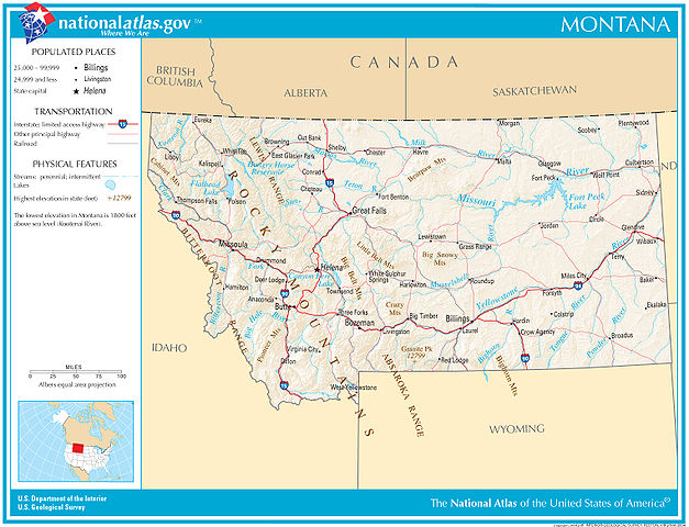
| current | 06:04, 14 December 2007 | | 1,526 × 1,168 (627 KB) | commons>Sagredo | {{Information |Description=Map of Montana |Source=nationalatlas.gov |Date=December 2007 |Author=US Department of Interior, US Geological Survey |Permission= |other_versions= }} |
File usage
There are no pages that use this file.