File:Map of the partition of the Kingdom of Poland and the Grand Duchy of Lithuania from 1799.jpg
Jump to navigation
Jump to search
Size of this preview: 669 × 600 pixels. Other resolutions: 268 × 240 pixels | 535 × 480 pixels | 856 × 768 pixels | 1,142 × 1,024 pixels | 2,284 × 2,048 pixels | 6,330 × 5,677 pixels.
Original file (6,330 × 5,677 pixels, file size: 6.83 MB, MIME type: image/jpeg)
File history
Click on a date/time to view the file as it appeared at that time.
| Date/Time | Thumbnail | Dimensions | User | Comment | |
|---|---|---|---|---|---|
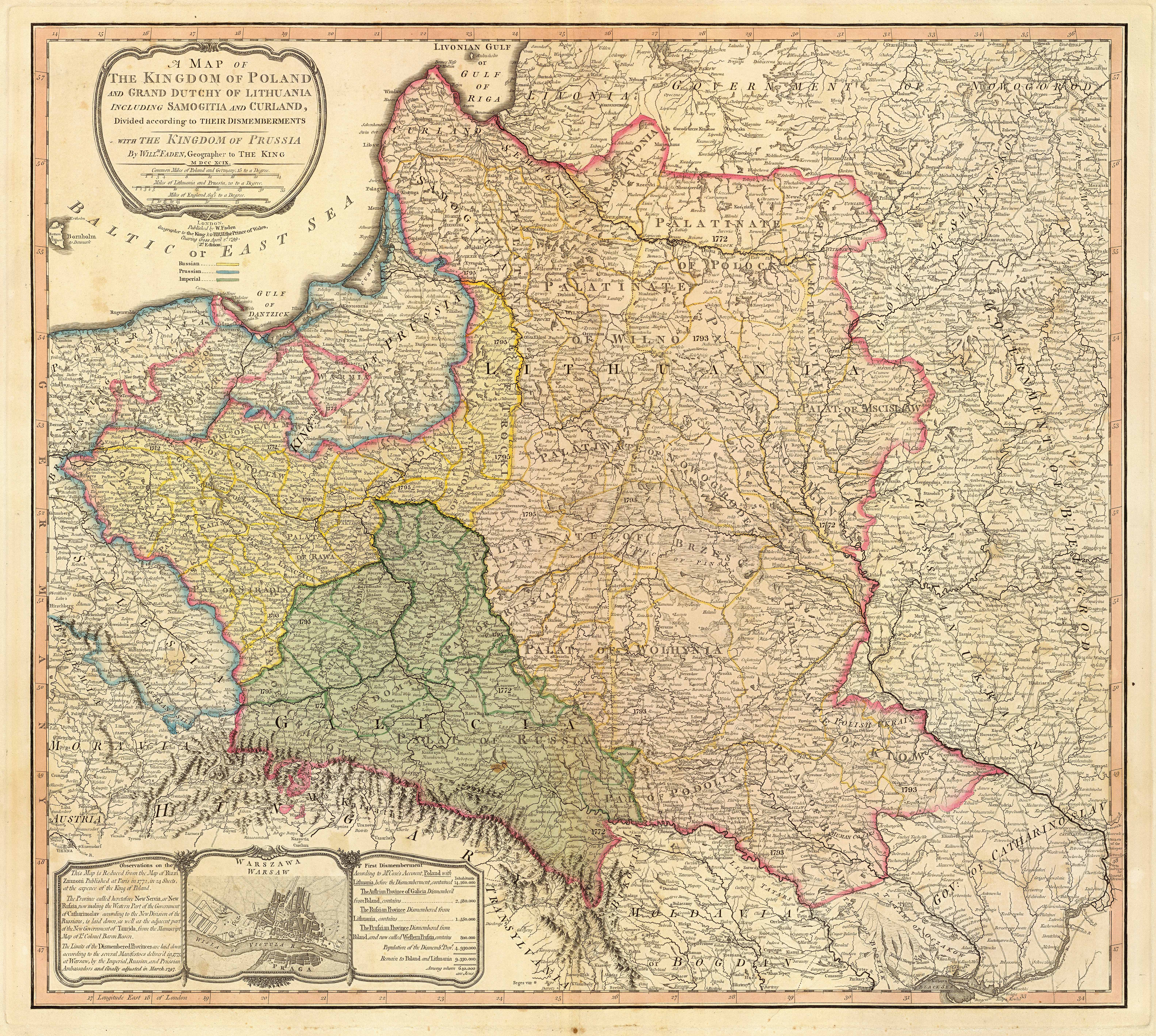
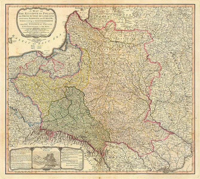
| current | 05:04, 23 September 2007 | | 6,330 × 5,677 (6.83 MB) | commons>Archaeogenetics | {{Information |Description=Title: "A map of the Kingdom of Poland and the Grand Duchy of Lithuania including Samogitia and Curland divided according to their dismemberments with the Kingdom of Prussia". A map from 1799 showing how the Polish-Lithuanian Co |
File usage
There are no pages that use this file.