File:Map of the Holy Roman Empire (1618) - DE.svg
Jump to navigation
Jump to search

Size of this PNG preview of this SVG file: 658 × 600 pixels. Other resolutions: 263 × 240 pixels | 527 × 480 pixels | 843 × 768 pixels | 1,123 × 1,024 pixels | 2,247 × 2,048 pixels | 2,769 × 2,524 pixels.
Original file (SVG file, nominally 2,769 × 2,524 pixels, file size: 4.24 MB)
_-_DE.svg)
Summary
| Description |
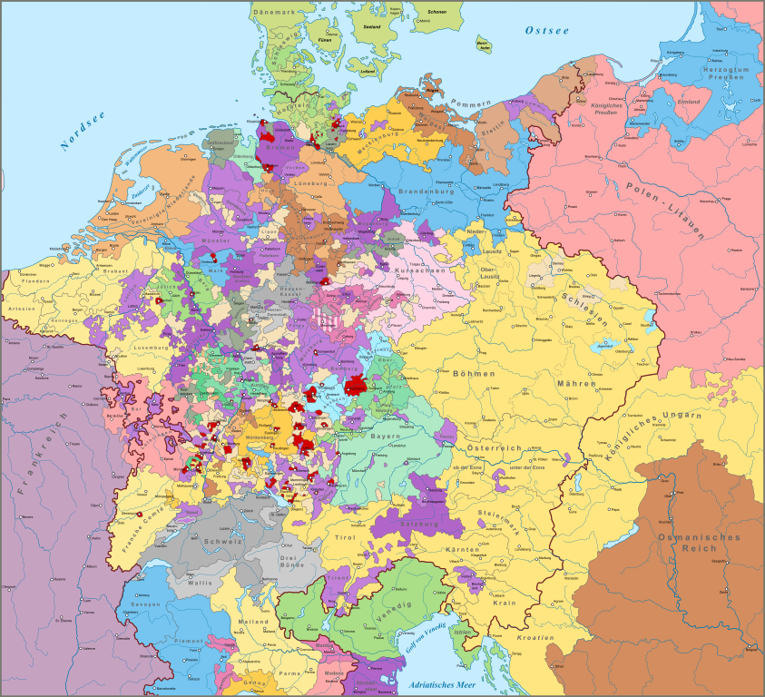
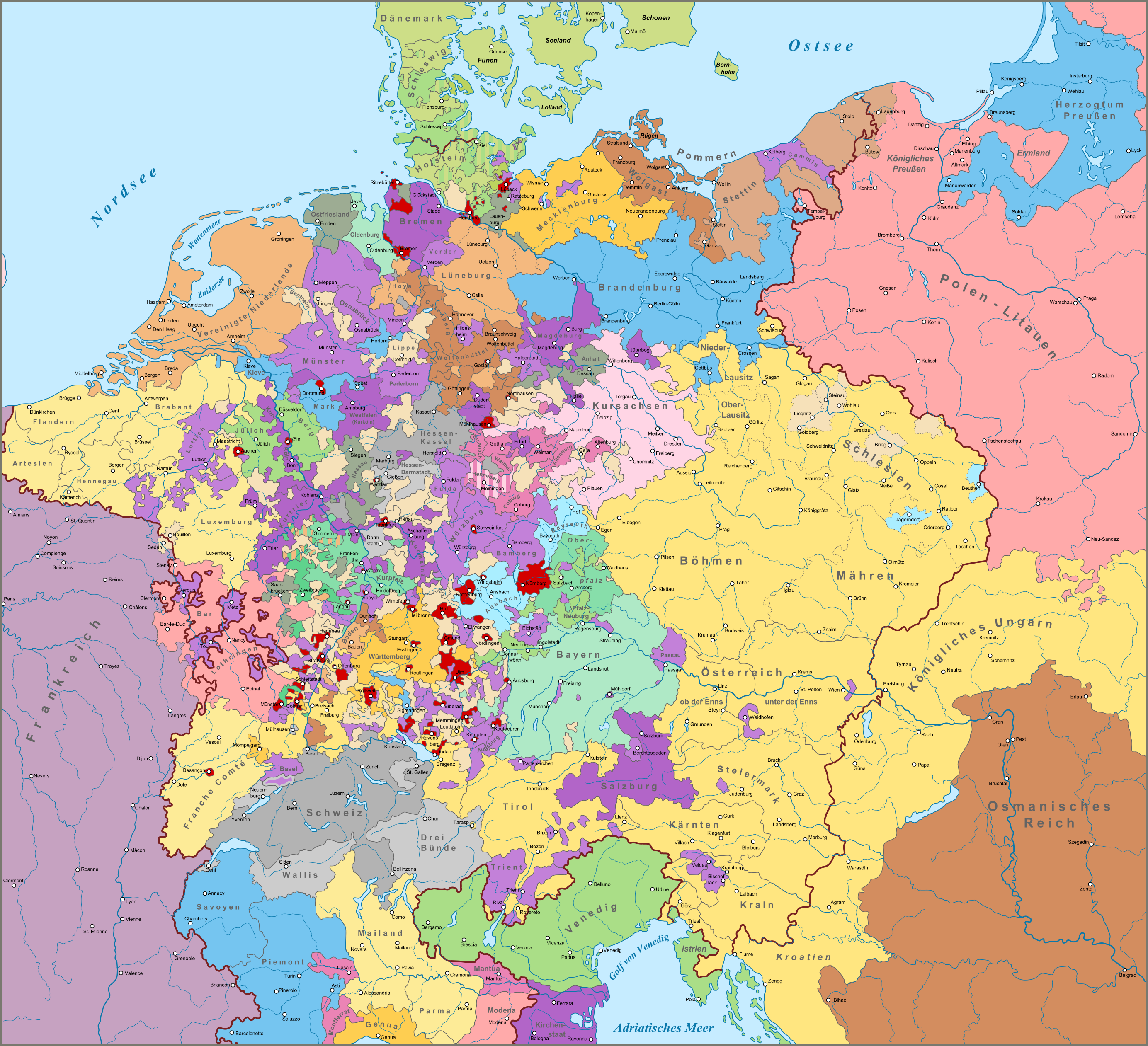
English: Map of the Holy Roman Empire in 1618, on the eve of the Thirty Years War. German version.
Nederlands: Kaart van het Heilige Roomse Rijk in 1618, aan de vooravond van de Dertigjarige Oorlog. Duitse versie.
Deutsch: Karte des Heiligen Römischen Reiches im Jahr 1618 am Vorabend des Dreißigjährigen Krieges. |
| Date | |
| Source |
|
| Author |
This W3C-unspecified vector image was created with Inkscape . |
Licensing
I, the copyright holder of this work, hereby publish it under the following license:
This file is licensed under the Creative Commons Attribution-Share Alike 4.0 International license.
- You are free:
- to share – to copy, distribute and transmit the work
- to remix – to adapt the work
- Under the following conditions:
- attribution – You must give appropriate credit, provide a link to the license, and indicate if changes were made. You may do so in any reasonable manner, but not in any way that suggests the licensor endorses you or your use.
- share alike – If you remix, transform, or build upon the material, you must distribute your contributions under the same or compatible license as the original.
File history
Click on a date/time to view the file as it appeared at that time.
| Date/Time | Thumbnail | Dimensions | User | Comment | |
|---|---|---|---|---|---|
| current | 14:02, 26 December 2016 | | 2,769 × 2,524 (4.24 MB) | commons>Sir Iain | Fixed a few typo's and errors |
File usage
There are no pages that use this file.
_-_DE.svg)