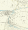
File:Map of the Flight of locks at Falkirk.png
Jump to navigation
Jump to search

Size of this preview: 552 × 600 pixels. Other resolutions: 221 × 240 pixels | 442 × 480 pixels | 836 × 908 pixels.
Original file (836 × 908 pixels, file size: 896 KB, MIME type: image/png)
File history
Click on a date/time to view the file as it appeared at that time.
| Date/Time | Thumbnail | Dimensions | User | Comment | |
|---|---|---|---|---|---|
| current | 22:28, 30 May 2020 |  | 836 × 908 (896 KB) | commons>Knipptang | =={{int:filedesc}}== {{Information |description={{en|1=Part of OS sheet XXX.2 showing the flight of canal locks at Falkirk and a section of the Antonine Wall between Rough Castle and Camelon at a scale of 1:2,500 or about 25 inches to one mile. Second Edition, 1897}} |date=1897-12-31 |source={{NLS Collections}} https://maps.nls.uk/geo/explore/side-by-side/#zoom=16&lat=55.99833&lon=-3.81570&layers=168&right=BingHyb |author=Director General of the Ordnance Survey, UK |permission= |other version... |
File usage
There are no pages that use this file.