File:Map of northern Iran under late Sasanian rule.png
Jump to navigation
Jump to search

Size of this preview: 800 × 397 pixels. Other resolutions: 320 × 159 pixels | 640 × 317 pixels | 1,024 × 508 pixels | 1,789 × 887 pixels.
Original file (1,789 × 887 pixels, file size: 1.53 MB, MIME type: image/png)
File history
Click on a date/time to view the file as it appeared at that time.
| Date/Time | Thumbnail | Dimensions | User | Comment | |
|---|---|---|---|---|---|
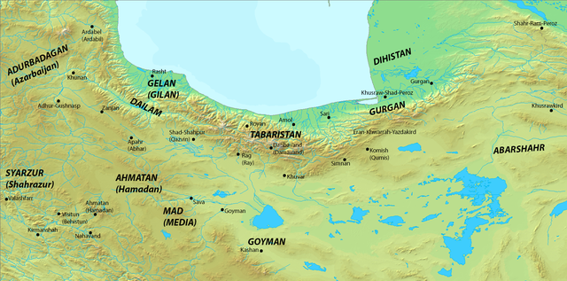
| current | 00:55, 19 June 2014 | | 1,789 × 887 (1.53 MB) | commons>HistoryofIran | =={{int:filedesc}}== {{Information |description={{en|1=Map of northern Iran under late Sasanian rule. *Map taken from [http://www2.demis.nl/ DEMIS Mapserver], which is public domain, the rest is self-made.}} |date=2014... |
File usage
There are no pages that use this file.