File:Map of USA highlighting Sun Belt.png
Jump to navigation
Jump to search
No higher resolution available.
Map_of_USA_highlighting_Sun_Belt.png (280 × 183 pixels, file size: 40 KB, MIME type: image/png)
File history
Click on a date/time to view the file as it appeared at that time.
| Date/Time | Thumbnail | Dimensions | User | Comment | |
|---|---|---|---|---|---|
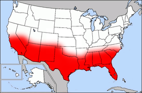
| current | 17:41, 27 September 2006 | | 280 × 183 (40 KB) | commons>Mr Bullitt~commonswiki | Public domain map courtesy of [http://www.lib.utexas.edu/ The General Libraries, The University of Texas at Austin], modified (by • Benc • 00:36, 13 Aug 2004 (UTC)) to highlight regions. Originally uploaded |
File usage
There are no pages that use this file.