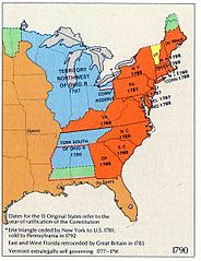
File:Map of Territorial Growth 1790 sm.jpg
Jump to navigation
Jump to search

Size of this preview: 461 × 599 pixels. Other resolutions: 184 × 240 pixels | 369 × 480 pixels | 923 × 1,200 pixels.
Original file (923 × 1,200 pixels, file size: 91 KB, MIME type: image/jpeg)
File history
Click on a date/time to view the file as it appeared at that time.
| Date/Time | Thumbnail | Dimensions | User | Comment | |
|---|---|---|---|---|---|
| current | 15:29, 10 September 2007 | | 923 × 1,200 (91 KB) | commons>BetacommandBot | Transwiki approved by: w:en:User:Dmcdevit This image was copied from wikipedia:en. The original description was: {{badJPEG}} {{PD-USGov-Atlas}} w:en:Category:National Atlas territorial expansion maps === File history === {| class=wikitable ! d |
File usage
There are no pages that use this file.