File:Map of Prairie Township, Warren County, Indiana.svg
Jump to navigation
Jump to search

Size of this PNG preview of this SVG file: 600 × 600 pixels. Other resolutions: 240 × 240 pixels | 480 × 480 pixels | 768 × 768 pixels | 1,024 × 1,024 pixels | 2,048 × 2,048 pixels.
Original file (SVG file, nominally 768 × 768 pixels, file size: 242 KB)
File history
Click on a date/time to view the file as it appeared at that time.
| Date/Time | Thumbnail | Dimensions | User | Comment | |
|---|---|---|---|---|---|
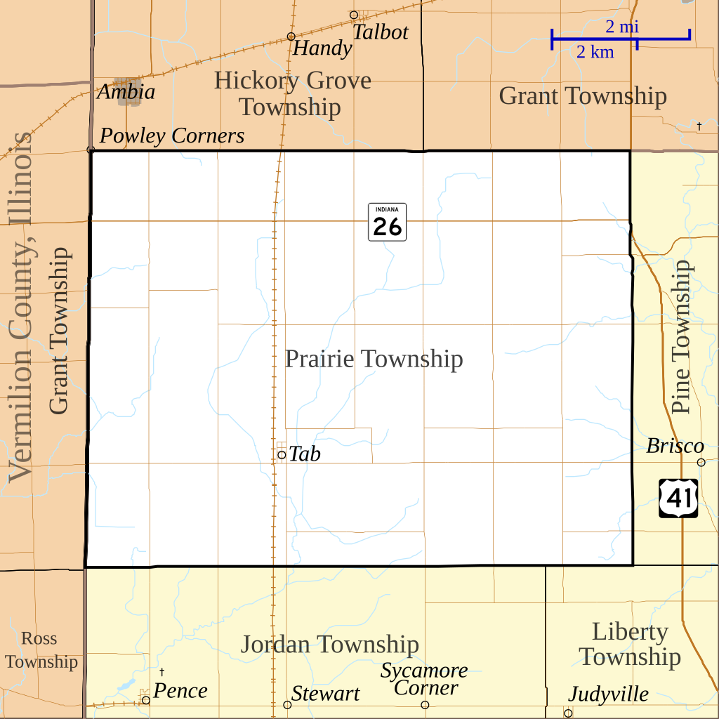
| current | 15:43, 27 January 2011 | | 768 × 768 (242 KB) | commons>Omnedon | == {{int:filedesc}} == {{Information |Description={{en|This is a map of Prairie Township, Warren County, Indiana, USA.}} |Source=My own work, using custom-written MapScript applications with [http://www.cens |
File usage
There are no pages that use this file.