File:Map of Ohio NA.png
Jump to navigation
Jump to search

Size of this preview: 800 × 542 pixels. Other resolutions: 320 × 217 pixels | 640 × 434 pixels | 1,024 × 694 pixels | 1,280 × 867 pixels | 1,967 × 1,333 pixels.
Original file (1,967 × 1,333 pixels, file size: 2.02 MB, MIME type: image/png)
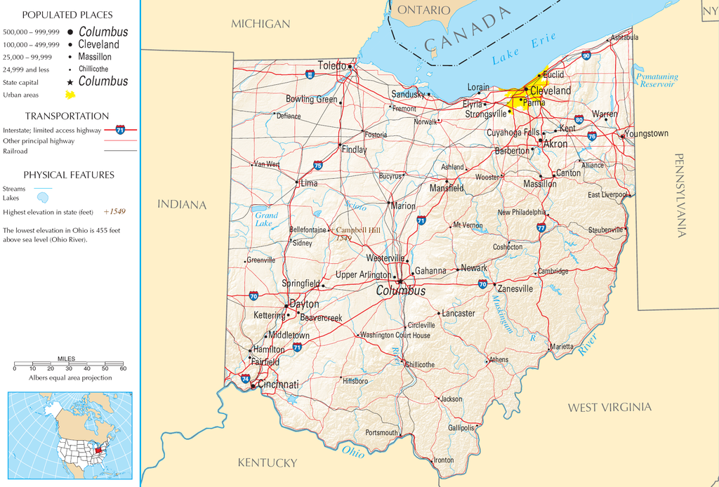
| Description | Map of Ohio |
| Source | National Atlas |
| Author |
This map was obtained from an edition of the National Atlas of the United States. Like almost all works of the U.S. federal government, works from the National Atlas are in the public domain in the United States.
Online access: NationalAtlas.gov | 1970 print edition: Library of Congress, Perry-Castañeda Library
|
File history
Click on a date/time to view the file as it appeared at that time.
| Date/Time | Thumbnail | Dimensions | User | Comment | |
|---|---|---|---|---|---|
| current | 11:21, 30 August 2007 | | 1,967 × 1,333 (2.02 MB) | commons>Conscious | cropped |
File usage
There are no pages that use this file.