File:Map of Morocco and Western Sahara-fr.svg
Jump to navigation
Jump to search

Size of this PNG preview of this SVG file: 531 × 599 pixels. Other resolutions: 213 × 240 pixels | 425 × 480 pixels | 681 × 768 pixels | 908 × 1,024 pixels | 1,816 × 2,048 pixels | 625 × 705 pixels.
Original file (SVG file, nominally 625 × 705 pixels, file size: 234 KB)
File history
Click on a date/time to view the file as it appeared at that time.
| Date/Time | Thumbnail | Dimensions | User | Comment | |
|---|---|---|---|---|---|
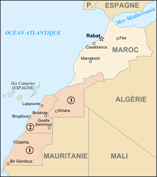
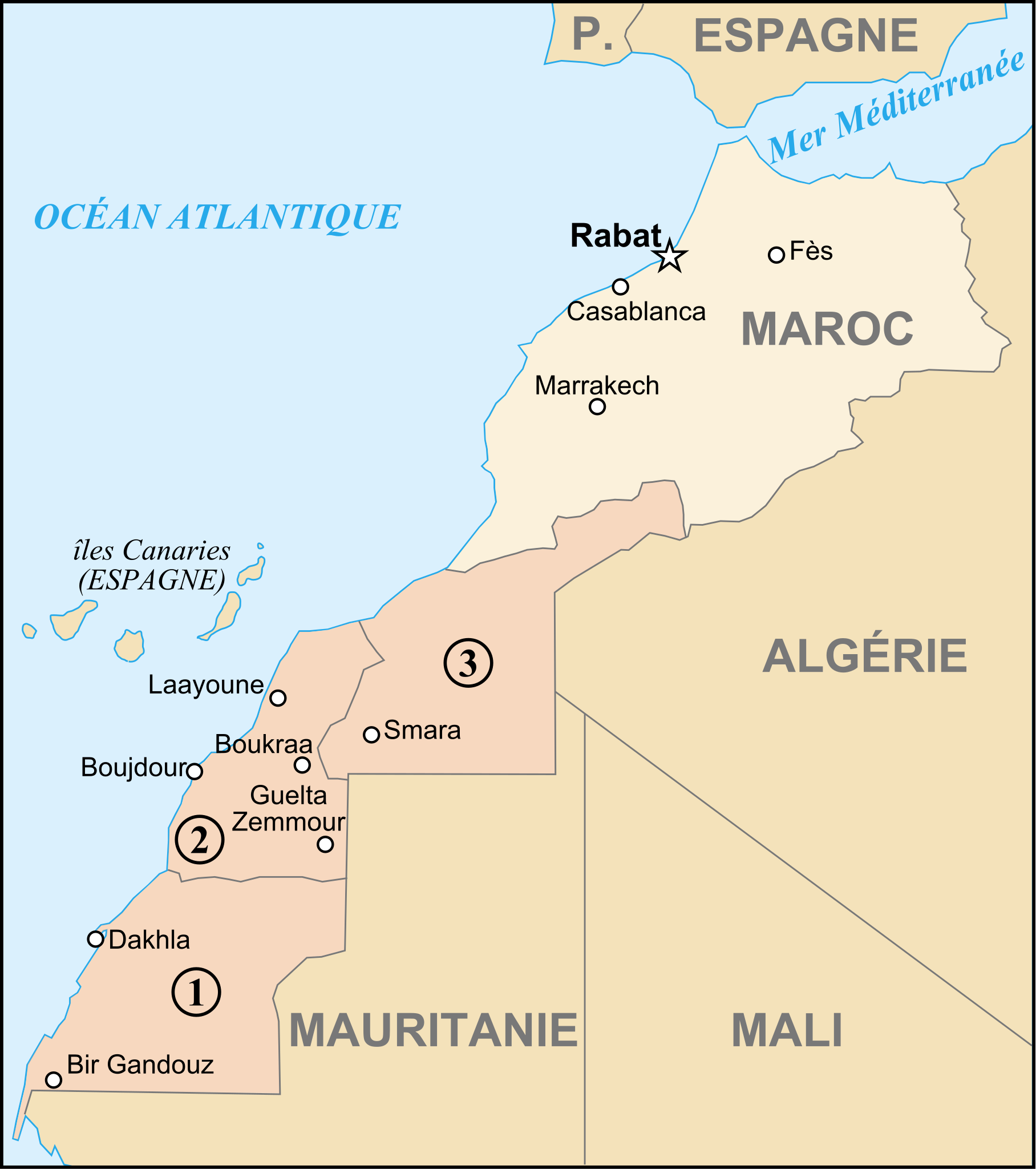
| current | 00:27, 8 August 2007 | | 625 × 705 (234 KB) | commons>Historicair | {{Information |Description={{fr}}Carte du Maroc et du Sahara Occidental {{en}}Map of Marocco and Western Sahara |Source=fr:Image:Régions du sud.png + Image:Maroc carte.gif + Image:Sahara occidental CIA WFB.png + Own work |Date=08/08/2007 | |
File usage
There are no pages that use this file.