File:Map of Laysan Island.jpg
Jump to navigation
Jump to search

Size of this preview: 365 × 599 pixels. Other resolutions: 146 × 240 pixels | 292 × 480 pixels | 468 × 768 pixels | 624 × 1,024 pixels | 2,004 × 3,288 pixels.
Original file (2,004 × 3,288 pixels, file size: 3.34 MB, MIME type: image/jpeg)
File history
Click on a date/time to view the file as it appeared at that time.
| Date/Time | Thumbnail | Dimensions | User | Comment | |
|---|---|---|---|---|---|
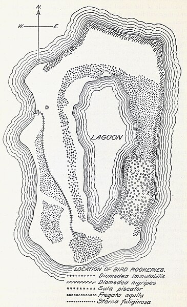
| current | 21:16, 6 May 2024 | | 2,004 × 3,288 (3.34 MB) | commons>FunkMonk | {{Information |Description=Map of Laysan Island from a report of an 1911 expedition. |Source=https://www.biodiversitylibrary.org/item/128200#page/22/mode/1up |Date=1912 |Author=Homer R. Dill, WM Allanson Bryan |Permission= |other_versions= }} == {{int:license-header}} == {{PD-US-expired}} |
File usage
There are no pages that use this file.