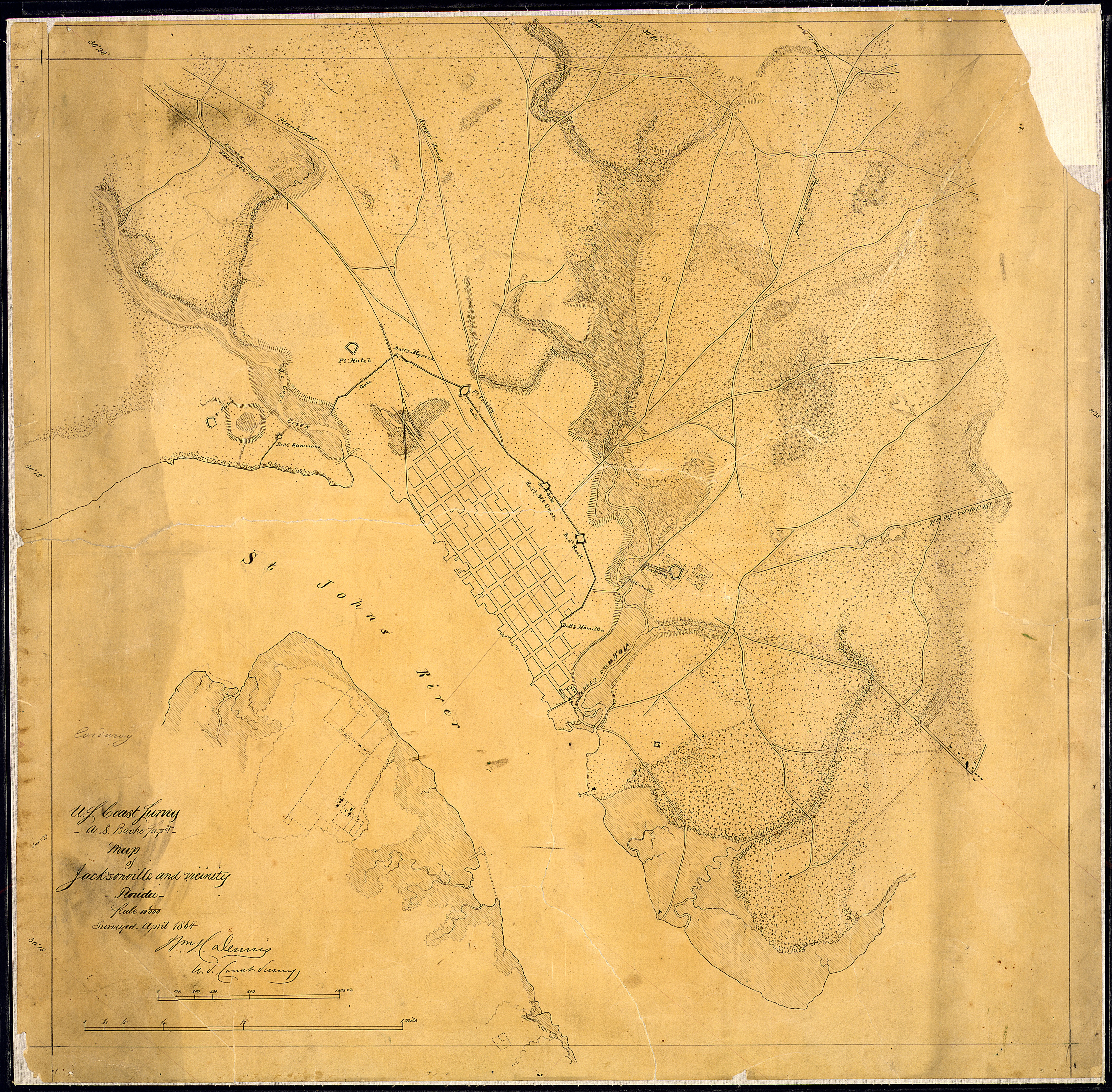
File:Map of Jacksonville and vicinity, Florida, (showing defenses). Surveyed April 1864. (Signed) Wm. H. Dennis, U. S.... - NARA - 305631.jpg
Jump to navigation
Jump to search
Size of this preview: 611 × 600 pixels. Other resolutions: 245 × 240 pixels | 489 × 480 pixels | 782 × 768 pixels | 1,043 × 1,024 pixels | 2,086 × 2,048 pixels | 4,400 × 4,319 pixels.
Original file (4,400 × 4,319 pixels, file size: 7.82 MB, MIME type: image/jpeg)
._Surveyed_April_1864._(Signed)_Wm._H._Dennis,_U._S...._-_NARA_-_305631.jpg)
File history
Click on a date/time to view the file as it appeared at that time.
| Date/Time | Thumbnail | Dimensions | User | Comment | |
|---|---|---|---|---|---|
| current | 07:15, 7 October 2011 | | 4,400 × 4,319 (7.82 MB) | commons>US National Archives bot | == {{int:filedesc}} == {{NARA-image-full | Title = Map of Jacksonville and vicinity, Florida, [showing defenses]. Surveyed April 1864. [Signed] Wm. H. Dennis, U. S. Coast Survey. | Scope and content = | General notes |
File usage
There are no pages that use this file.
._Surveyed_April_1864._(Signed)_Wm._H._Dennis,_U._S...._-_NARA_-_305631.jpg)