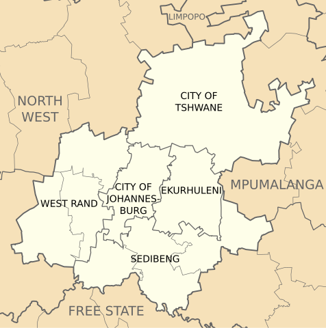
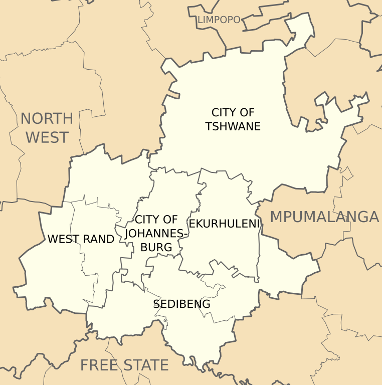
File:Map of Gauteng with municipalities labelled (2016).svg
Jump to navigation
Jump to search

Size of this PNG preview of this SVG file: 595 × 600 pixels. Other resolutions: 238 × 240 pixels | 476 × 480 pixels | 762 × 768 pixels | 1,016 × 1,024 pixels | 2,032 × 2,048 pixels | 754 × 760 pixels.
Original file (SVG file, nominally 754 × 760 pixels, file size: 258 KB)
.svg)
File history
Click on a date/time to view the file as it appeared at that time.
| Date/Time | Thumbnail | Dimensions | User | Comment | |
|---|---|---|---|---|---|
| current | 22:35, 2 September 2016 | | 754 × 760 (258 KB) | commons>Htonl | == {{int:filedesc}} == {{Information |Description ={{en|1=Map of municipal boundaries in Gauteng, as they will be after the municipal elections of 3 August 2016, with the names of the munici... |
File usage
There are no pages that use this file.
.svg)