File:Map of Danish Settlements in India (1620 - 1845).svg
Jump to navigation
Jump to search

Size of this PNG preview of this SVG file: 512 × 446 pixels. Other resolutions: 276 × 240 pixels | 551 × 480 pixels | 882 × 768 pixels | 1,176 × 1,024 pixels | 2,351 × 2,048 pixels.
Original file (SVG file, nominally 512 × 446 pixels, file size: 162 KB)
.svg)
File history
Click on a date/time to view the file as it appeared at that time.
| Date/Time | Thumbnail | Dimensions | User | Comment | |
|---|---|---|---|---|---|
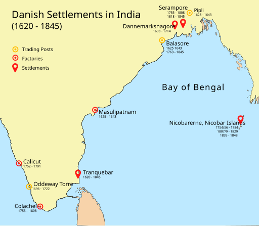
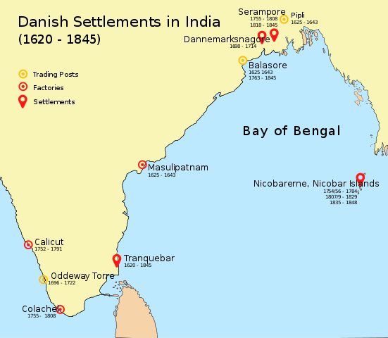
| current | 09:07, 7 May 2018 | | 512 × 446 (162 KB) | commons>Adondai | {{subst:Upload marker added by en.wp UW}} {{Information |Description = {{en|Map of Danish settlements and trading posts in India from 1620 - 1845}} |Source = Created using illustrator |Date = 2018-05-07 |Author = Adondai }} {{cc-zero}} |
File usage
There are no pages that use this file.
.svg)