File:Map of Cambrai 1710.jpg
Jump to navigation
Jump to search
Size of this preview: 800 × 573 pixels. Other resolutions: 320 × 229 pixels | 640 × 459 pixels | 1,024 × 734 pixels | 1,280 × 917 pixels | 1,884 × 1,350 pixels.
Original file (1,884 × 1,350 pixels, file size: 841 KB, MIME type: image/jpeg)
File history
Click on a date/time to view the file as it appeared at that time.
| Date/Time | Thumbnail | Dimensions | User | Comment | |
|---|---|---|---|---|---|
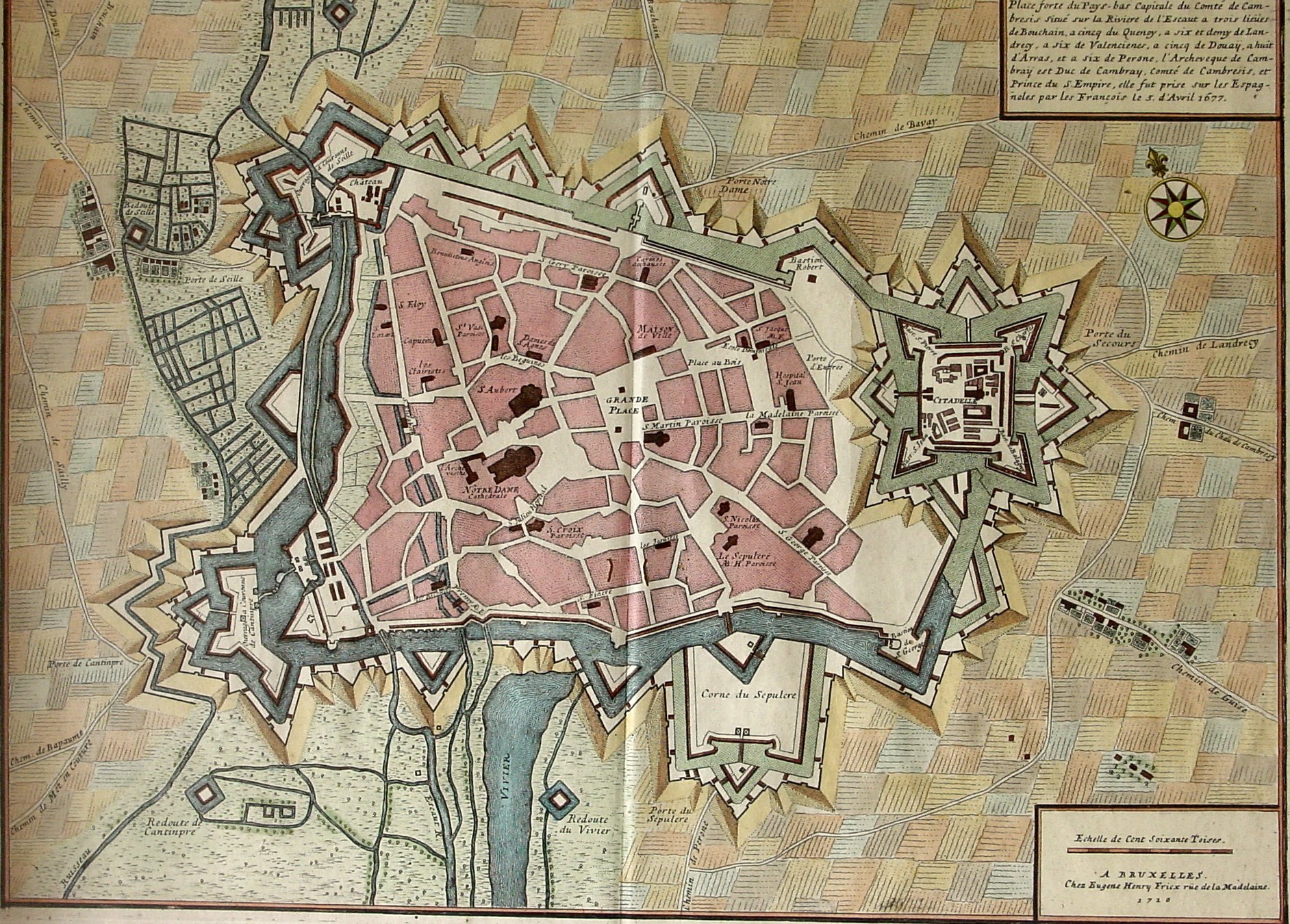
| current | 16:23, 14 October 2007 | | 1,884 × 1,350 (841 KB) | commons>Camster | {{Information |Description=Plan de Cambrai fait en 1710 chez Eugène Henry Friex rue de la Madelaine à Bruxelles |Source=travail personnel |Date=10 avril 2007 (image cropped 14 oct 2007) |Author= Camster2 }} Category:Cambrai [[Cate |
File usage
There are no pages that use this file.