File:Map of Bulgaria and Eastern Rumelia in 1882.jpg

Original file (1,420 × 1,012 pixels, file size: 257 KB, MIME type: image/jpeg)
Summary
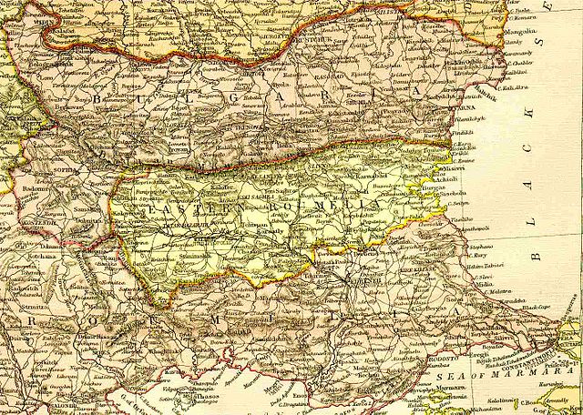
A map of the Principality of Bulgaria and Eastern Rumelia before the unification of Bulgaria in 1885. The map is from an 1882 atlas.
Image history at en:
(del) (cur) 09:01, 6 September 2005 . . TodorBozhinov . . 1420x1012 (263299 bytes) (A map of the Principality of...)
Licensing
|
This work is in the public domain in its country of origin and other countries and areas where the copyright term is the author's life plus 70 years or fewer.
| |
| This file has been identified as being free of known restrictions under copyright law, including all related and neighboring rights. | |
File history
Click on a date/time to view the file as it appeared at that time.
| Date/Time | Thumbnail | Dimensions | User | Comment | |
|---|---|---|---|---|---|
| current | 01:33, 20 September 2005 | | 1,420 × 1,012 (257 KB) | commons>Thuresson | A map of the Principality of Bulgaria and Eastern Rumelia before the unification of Bulgaria in 1885. The map is from an 1882 atlas. Image history at en: (del) (cur) 09:01, 6 September 2005 . . TodorBozhinov . . 1420x1012 (263 |
File usage
There are no pages that use this file.