File:Map of Broughton.jpg
Jump to navigation
Jump to search
Size of this preview: 797 × 600 pixels. Other resolutions: 319 × 240 pixels | 638 × 480 pixels | 1,021 × 768 pixels | 1,280 × 963 pixels | 2,560 × 1,926 pixels | 2,883 × 2,169 pixels.
Original file (2,883 × 2,169 pixels, file size: 1.89 MB, MIME type: image/jpeg)
File history
Click on a date/time to view the file as it appeared at that time.
| Date/Time | Thumbnail | Dimensions | User | Comment | |
|---|---|---|---|---|---|
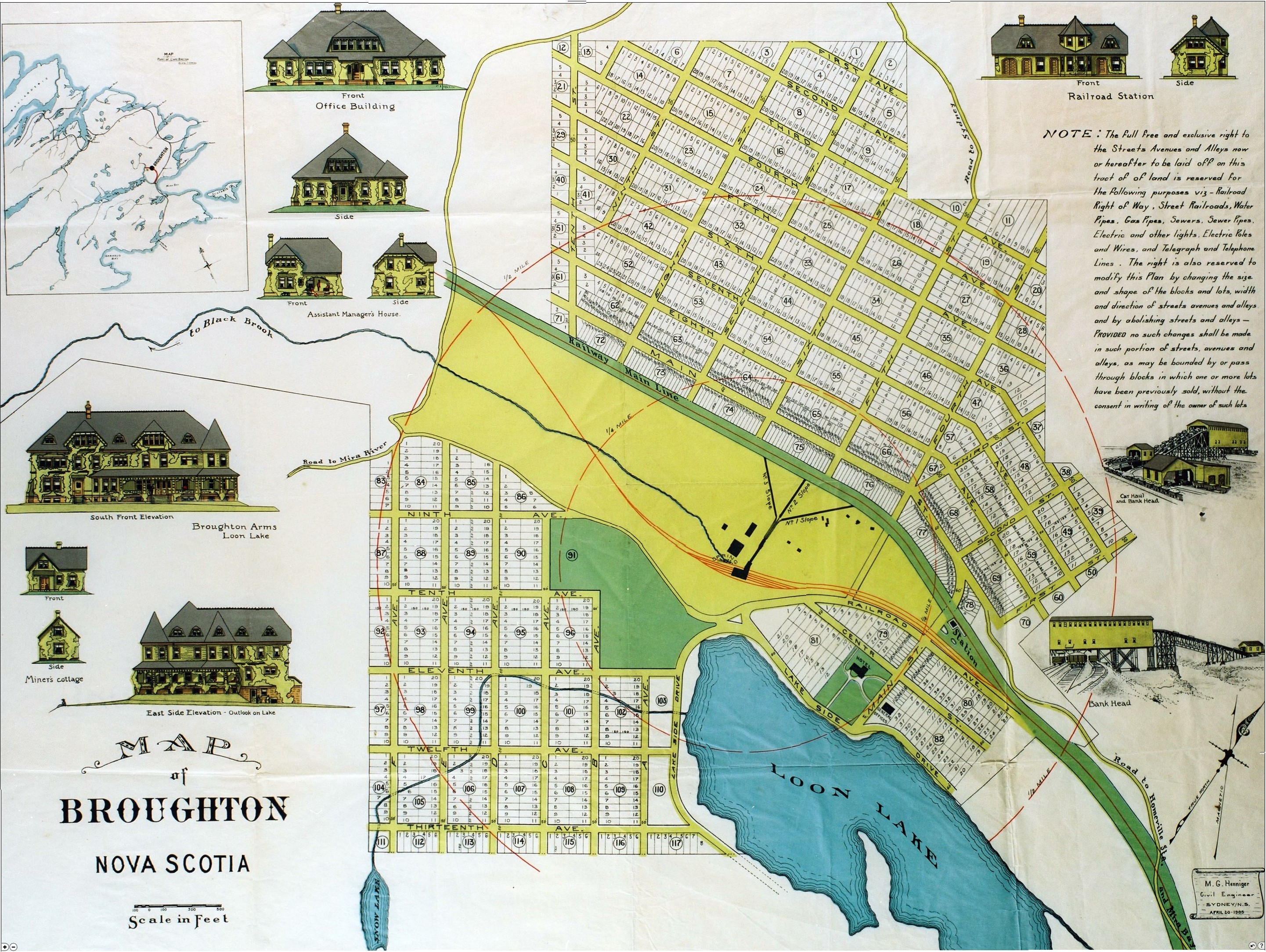
| current | 20:13, 10 January 2013 | | 2,883 × 2,169 (1.89 MB) | commons>Djsasso | {{Information |Description={{en|Map of town of Broughton, Nova Scotia, Canada. Map published in 1905 as per Nova Scotia archives. File Source: http://www.gov.ns.ca/nsarm/virtual/meninmines/exhibit.asp?ID=220&Language=English}} |Source=Transferred from ... |
File usage
There are no pages that use this file.