File:Map-position-runavikar-kommuna-2009.png
Jump to navigation
Jump to search

Size of this preview: 450 × 600 pixels. Other resolutions: 180 × 240 pixels | 600 × 800 pixels.
Original file (600 × 800 pixels, file size: 33 KB, MIME type: image/png)
File history
Click on a date/time to view the file as it appeared at that time.
| Date/Time | Thumbnail | Dimensions | User | Comment | |
|---|---|---|---|---|---|
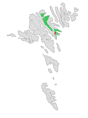
| current | 21:12, 2 January 2009 | | 600 × 800 (33 KB) | commons>Efloean | {{Information |Description={{en|1=Location of Runavíkar kommuna at the Faroe Islands, with borders as of 2009.}} {{no|1=Plassering av Runavíkar kommuna på Færøyene, med grensene av 2009.}} |Source=Own work, based on free image by [[user:Arne List|Arn |
File usage
There are no pages that use this file.