File:MATS International Route Map 1948.png
Jump to navigation
Jump to search
Size of this preview: 725 × 600 pixels. Other resolutions: 290 × 240 pixels | 581 × 480 pixels | 929 × 768 pixels | 1,238 × 1,024 pixels | 1,572 × 1,300 pixels.
Original file (1,572 × 1,300 pixels, file size: 3.25 MB, MIME type: image/png)
File history
Click on a date/time to view the file as it appeared at that time.
| Date/Time | Thumbnail | Dimensions | User | Comment | |
|---|---|---|---|---|---|
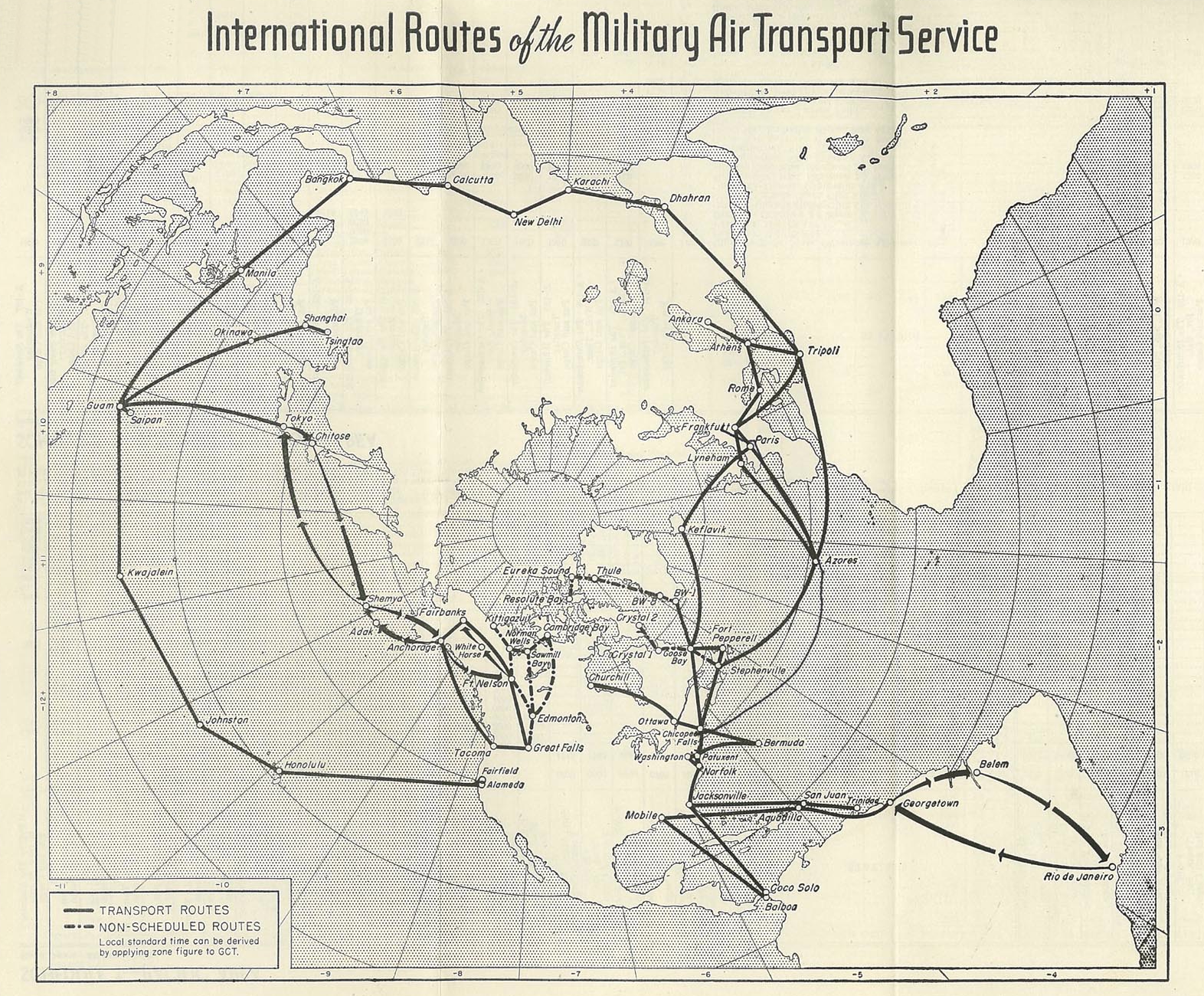
| current | 00:52, 29 October 2010 | | 1,572 × 1,300 (3.25 MB) | commons>Bwmoll3 | {{Information |Description={{en|1=International route map of Military Air Transport Service, 1948}} |Source=Scheduled Domestic and International Routes, Military Air Transport Service, USAF. US Government Printing office Document 16-55536-1, 1 July 1948 |
File usage
There are no pages that use this file.