File:M’zab Valley, Algeria.jpg
Jump to navigation
Jump to search

Size of this preview: 309 × 600 pixels. Other resolutions: 123 × 240 pixels | 247 × 480 pixels | 395 × 768 pixels | 527 × 1,024 pixels | 1,055 × 2,048 pixels | 2,834 × 5,500 pixels.
Original file (2,834 × 5,500 pixels, file size: 4.14 MB, MIME type: image/jpeg)
Summary
| Description | |
| Date | |
| Source | NASA Earth Observatory |
| Author | Robert Simmon and Jesse Allen |
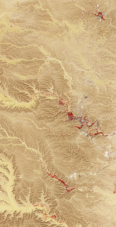
Image captured by the Advanced Spaceborne Thermal Emission and Reflection Radiometer (ASTER) on NASA’s Terra satellite. Data from the GSFC/METI/ERSDAC/JAROS, and U.S./Japan ASTER Science Team.
Licensing
| This file is in the public domain in the United States because it was solely created by NASA. NASA copyright policy states that "NASA material is not protected by copyright unless noted". (See Template:PD-USGov, NASA copyright policy page or JPL Image Use Policy.) | ||
 |
Warnings:
|
| Annotations | This image is annotated: View the annotations at Commons |
File history
Click on a date/time to view the file as it appeared at that time.
| Date/Time | Thumbnail | Dimensions | User | Comment | |
|---|---|---|---|---|---|
| current | 12:00, 11 July 2011 | | 2,834 × 5,500 (4.14 MB) | commons>Originalwana | {{Information |Description ={{en|1=Image of M’zab Valley. Bare rock ranges in colour from beige to peach. Buildings and paved surfaces appear gray. Vegetation is red, and brighter shades of red indicate |
File usage
There are no pages that use this file.