File:Lombardy WV regions map EN.png
Jump to navigation
Jump to search
Size of this preview: 633 × 600 pixels. Other resolutions: 253 × 240 pixels | 507 × 480 pixels | 811 × 768 pixels | 1,081 × 1,024 pixels | 1,800 × 1,705 pixels.
Original file (1,800 × 1,705 pixels, file size: 2.84 MB, MIME type: image/png)
Summary
| Description |
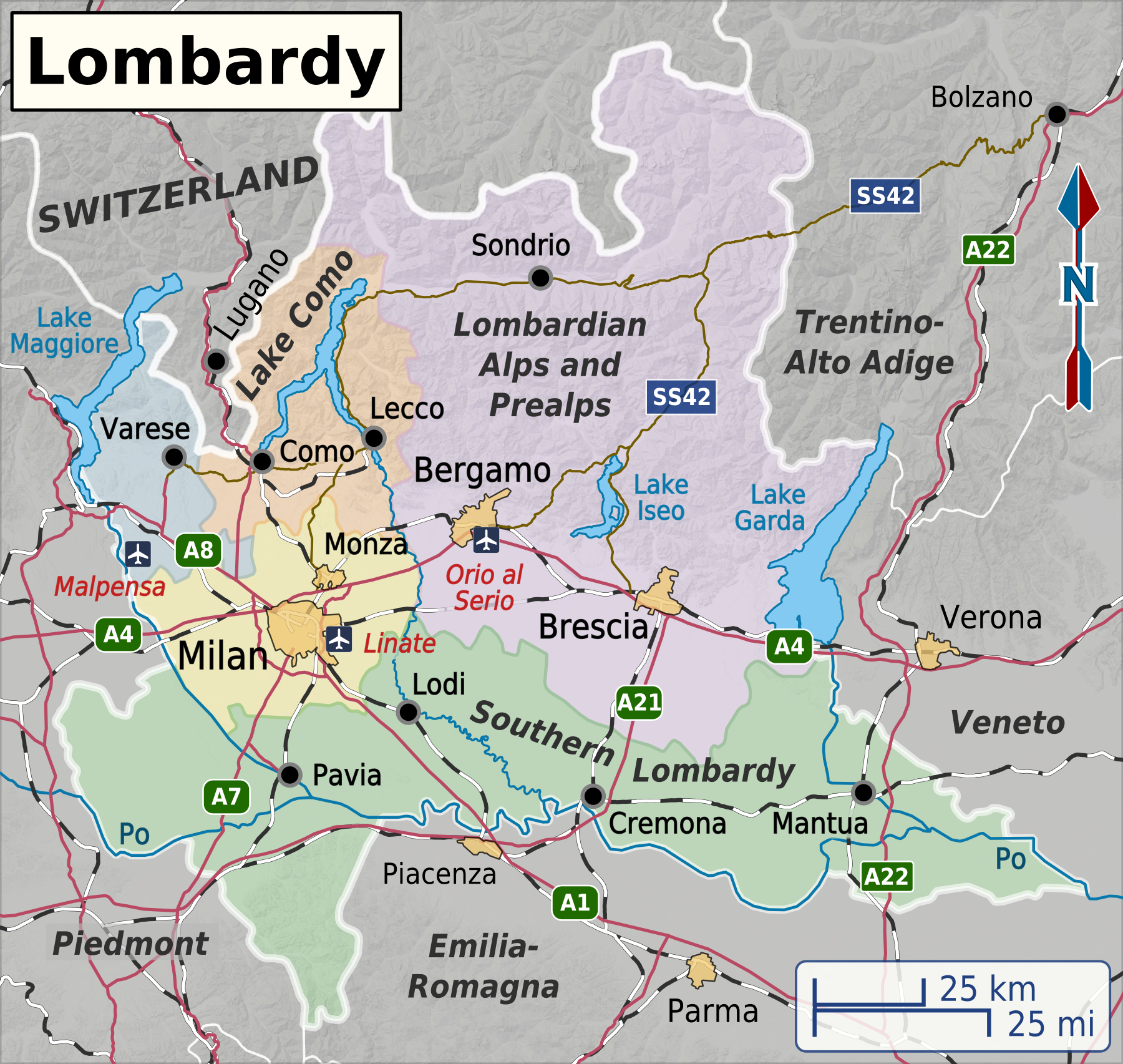
English: Map of Lombardy travel regions used in English Wikivoyage, including the travel regions, major cities and transportation routes. Red roads denote an Autostrada, brown roads are all other types of roads.
Map projection is Mercator. Approximate scale is 1:1,800,000. |
| Date | |
| Source | Own work, based on data from Natural Earth and map tiles from Openstreetmap.org. Shaded relief based on data from SRTM3 v3.0. |
| Author | Shaundd |
| Other versions |
|
Licensing
I, the copyright holder of this work, hereby publish it under the following license:
This file is licensed under the Creative Commons Attribution-Share Alike 4.0 International license.
- You are free:
- to share – to copy, distribute and transmit the work
- to remix – to adapt the work
- Under the following conditions:
- attribution – You must give appropriate credit, provide a link to the license, and indicate if changes were made. You may do so in any reasonable manner, but not in any way that suggests the licensor endorses you or your use.
- share alike – If you remix, transform, or build upon the material, you must distribute your contributions under the same or compatible license as the original.
File history
Click on a date/time to view the file as it appeared at that time.
| Date/Time | Thumbnail | Dimensions | User | Comment | |
|---|---|---|---|---|---|
| current | 06:02, 21 December 2014 | | 1,800 × 1,705 (2.84 MB) | commons>Shaundd | decrease size of highway shields and some text |
File usage
There are no pages that use this file.