File:Lochaber UK location map.svg
Jump to navigation
Jump to search

Size of this PNG preview of this SVG file: 800 × 501 pixels. Other resolutions: 320 × 201 pixels | 640 × 401 pixels | 1,024 × 642 pixels | 1,280 × 802 pixels | 2,560 × 1,604 pixels | 1,425 × 893 pixels.
Original file (SVG file, nominally 1,425 × 893 pixels, file size: 2.39 MB)
File history
Click on a date/time to view the file as it appeared at that time.
| Date/Time | Thumbnail | Dimensions | User | Comment | |
|---|---|---|---|---|---|
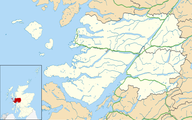
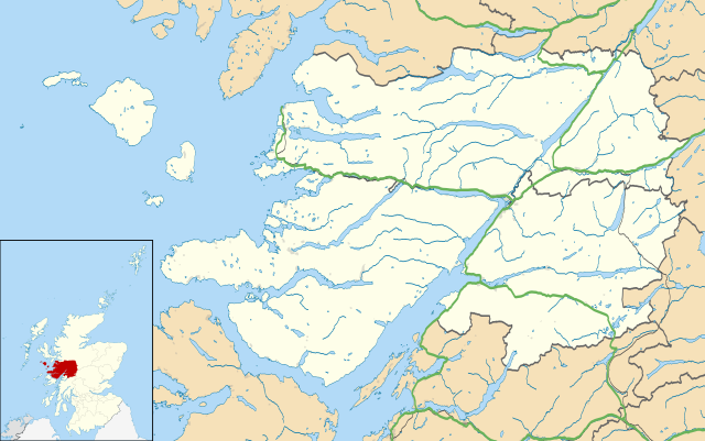
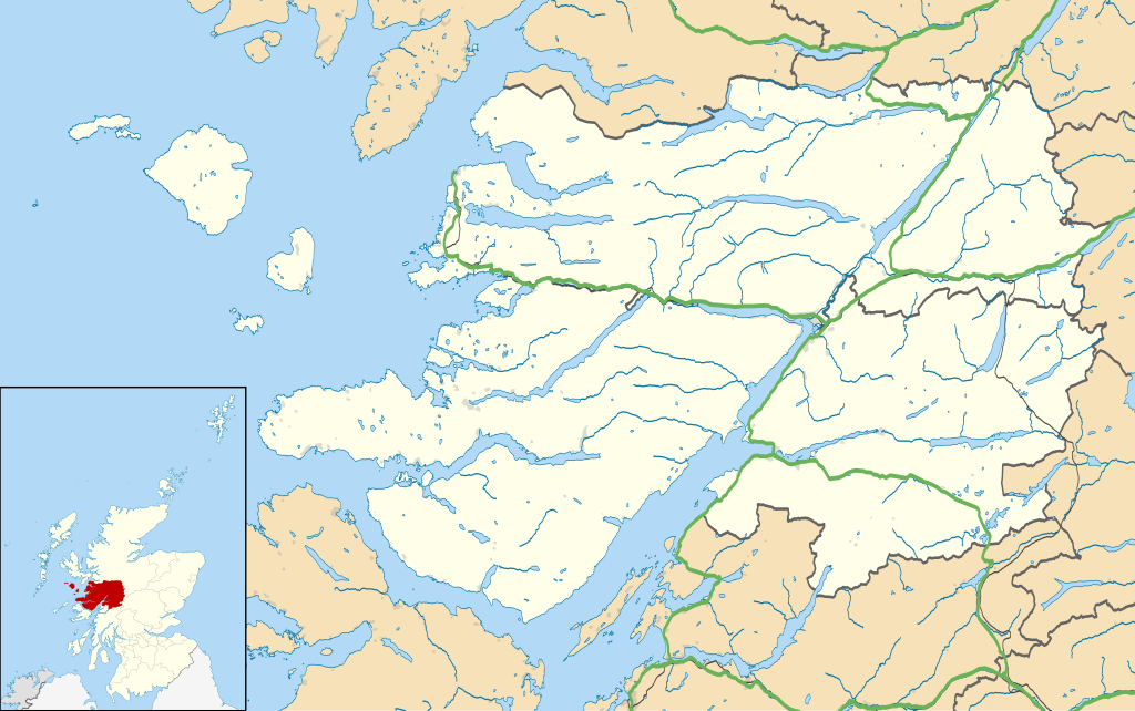
| current | 14:23, 13 February 2011 | | 1,425 × 893 (2.39 MB) | commons>Nilfanion | {{Information |Description=Map of the Lochaber ward management area, UK in 2011, with the following information shown: *Ward boundaries *Coastline, lakes and rivers *Roads and railways *Urban areas Equirectangular map projection on WGS 84 |
File usage
There are no pages that use this file.