File:Lika-Krbava County Map.jpg
Jump to navigation
Jump to search
Size of this preview: 765 × 600 pixels. Other resolutions: 306 × 240 pixels | 612 × 480 pixels | 979 × 768 pixels | 1,280 × 1,004 pixels | 2,100 × 1,647 pixels.
Original file (2,100 × 1,647 pixels, file size: 482 KB, MIME type: image/jpeg)
File history
Click on a date/time to view the file as it appeared at that time.
| Date/Time | Thumbnail | Dimensions | User | Comment | |
|---|---|---|---|---|---|
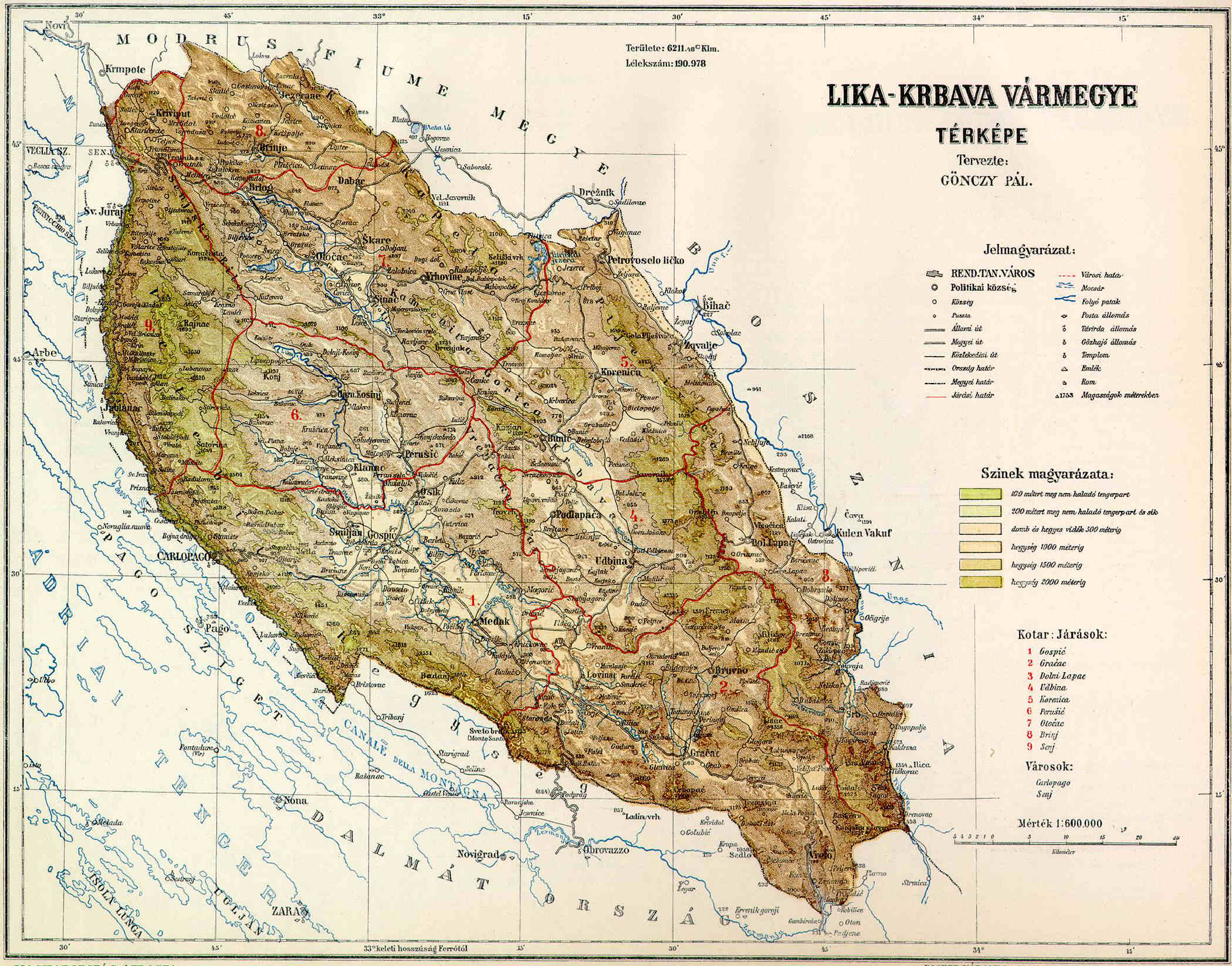
| current | 19:37, 28 April 2006 | | 2,100 × 1,647 (482 KB) | commons>Neoneo13 | Lika-Krbava County Map. Kingdom of Hungary. Croatia-Slavonia. Taken from Hungarian Wikipedia hu:Kép:Lika-Krbava vármegye térképe.jpg Category:Historical maps of Croatia Category:Historical maps of Hungary [[Category:Historical maps of Au |
File usage
There are no pages that use this file.