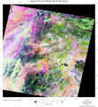
File:Landsate image of Zhawar Kili, in Khowst.png
Jump to navigation
Jump to search
Landsate_image_of_Zhawar_Kili,_in_Khowst.png (348 × 378 pixels, file size: 234 KB, MIME type: image/png)
File history
Click on a date/time to view the file as it appeared at that time.
| Date/Time | Thumbnail | Dimensions | User | Comment | |
|---|---|---|---|---|---|
| current | 06:14, 15 November 2008 |  | 348 × 378 (234 KB) | commons>Geo Swan | {{Information |Description={{en|1=Spectral ratio image of 30 meter resolution data from Landsat used to rapidly map the composition of the surface of Eastern Afghanistan and NW Pakistan. The colors were interpreted in terms of rock type based on field map |
File usage
There are no pages that use this file.
