File:LNOT railroad detail.jpg
Original file (1,800 × 2,700 pixels, file size: 698 KB, MIME type: image/jpeg)
Summary
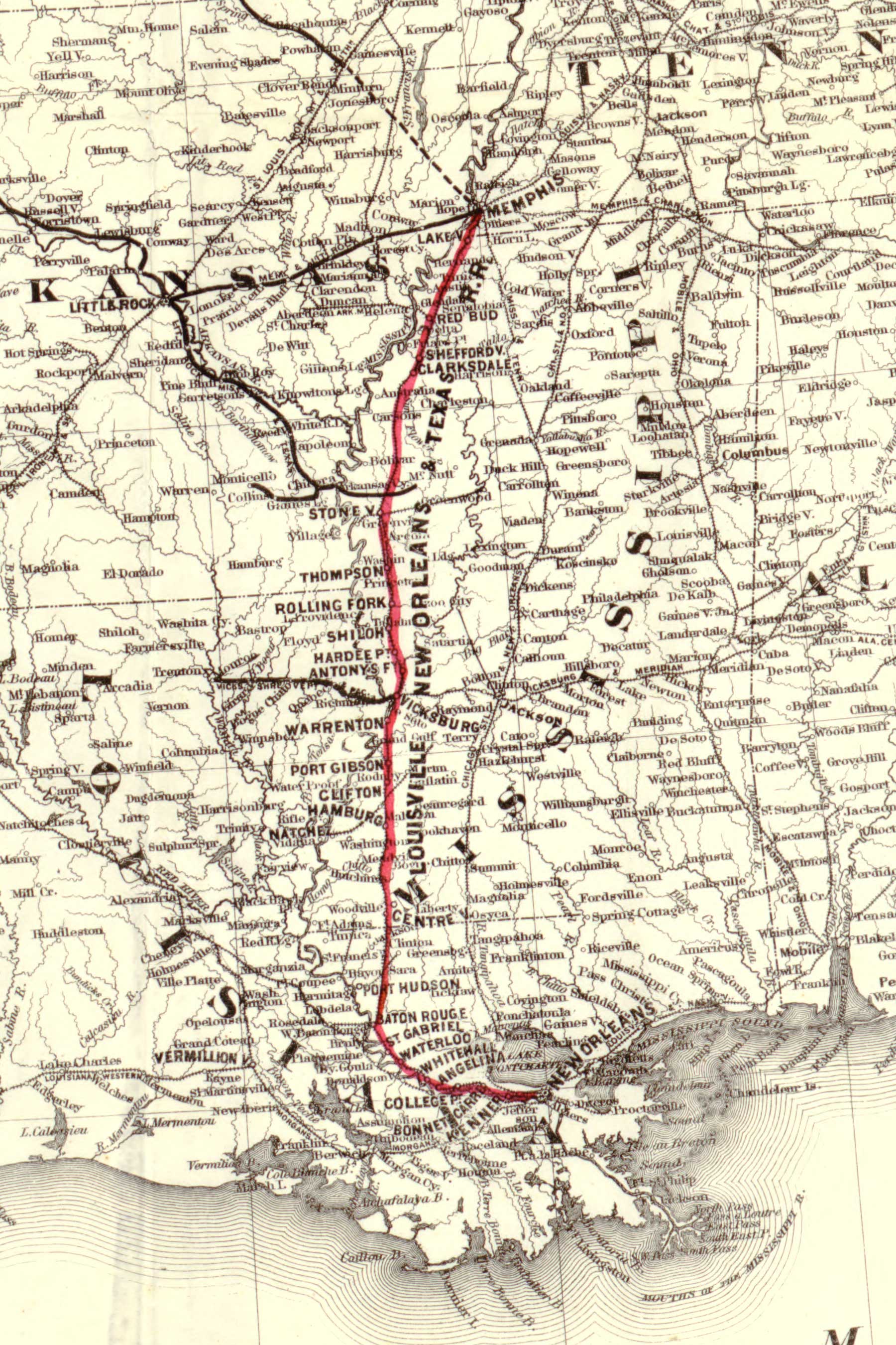
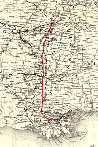
| Description | Map showing the route of the Louisville, New Orleans, and Texas Railroad and its connecting lines (detail). |
| Date | |
| Source | Library of Congress, Geography and Map Division, Washington, D.C. http://hdl.loc.gov/loc.gmd/g3701p.rr004520 |
| Author | G.W. & C.B. Colton & Co. |
Map showing the route of the Louisville, New Orleans, and Texas Railroad and its connecting lines.
G.W. & C.B. Colton & Co.
CREATED/PUBLISHED New York, 1883.
SUMMARY Map of the United States showing relief by hachures, drainage, state boundaries, cities and towns, and the railroad network with emphasis on the main line.
NOTES Scale ca. 1:3,800,000.
Reference: LC Railroad maps, 452
Description derived from published bibliography.
SUBJECTS
Louisville, New Orleans, and Texas Railroad.
Railroads--United States--Maps.
United States.
RELATED NAMES Louisville, New Orleans, and Texas Railroad.
MEDIUM col. map 46 x 112 cm.
CALL NUMBER G3701.P3 1883 .G19 RR 452
REPOSITORY Library of Congress Geography and Map Division Washington, D.C. 20540-4650 USA
DIGITAL ID g3701p rr004520 http://hdl.loc.gov/loc.gmd/g3701p.rr004520
Licensing
This media file is in the public domain in the United States. This applies to U.S. works where the copyright has expired, often because its first publication occurred prior to January 1, 1929, and if not then due to lack of notice or renewal. See this page for further explanation.
|
 | |
 |
This image might not be in the public domain outside of the United States; this especially applies in the countries and areas that do not apply the rule of the shorter term for US works, such as Canada, Mainland China (not Hong Kong or Macao), Germany, Mexico, and Switzerland. The creator and year of publication are essential information and must be provided. See Wikipedia:Public domain and Wikipedia:Copyrights for more details.
|
File history
Click on a date/time to view the file as it appeared at that time.
| Date/Time | Thumbnail | Dimensions | User | Comment | |
|---|---|---|---|---|---|
| current | 23:36, 29 September 2007 | | 1,800 × 2,700 (698 KB) | commons>Kkmurray | {{Information |Description=Map showing the route of the Louisville, New Orleans, and Texas Railroad and its connecting lines (detail). |Source=http://memory.loc.gov/ |Date= 1883 |Author=G.W. & C.B. Colton & Co. |Permission=Public Domain |other_versions= |
File usage
There are no pages that use this file.