File:Komárom county map.jpg
Jump to navigation
Jump to search

Size of this preview: 525 × 599 pixels. Other resolutions: 210 × 240 pixels | 420 × 480 pixels | 673 × 768 pixels | 897 × 1,024 pixels | 1,700 × 1,941 pixels.
Original file (1,700 × 1,941 pixels, file size: 377 KB, MIME type: image/jpeg)
File history
Click on a date/time to view the file as it appeared at that time.
| Date/Time | Thumbnail | Dimensions | User | Comment | |
|---|---|---|---|---|---|
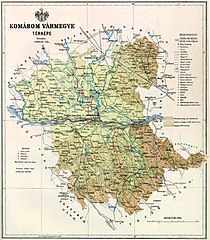
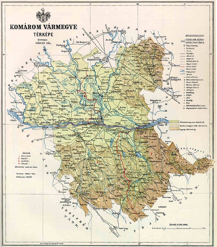
| current | 11:54, 8 June 2006 | | 1,700 × 1,941 (377 KB) | commons>Peppe83~commonswiki | Map of Komárom county in the Kingdom of Hungary (1891). Category:Counties in the Kingdom of Hungary |
File usage
There are no pages that use this file.