File:Kerch Strait Landsat.jpg
Jump to navigation
Jump to search

Size of this preview: 800 × 600 pixels. Other resolutions: 320 × 240 pixels | 640 × 480 pixels | 1,024 × 768 pixels | 1,280 × 960 pixels | 1,600 × 1,200 pixels.
Original file (1,600 × 1,200 pixels, file size: 294 KB, MIME type: image/jpeg)
Summary
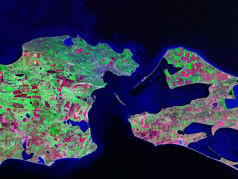
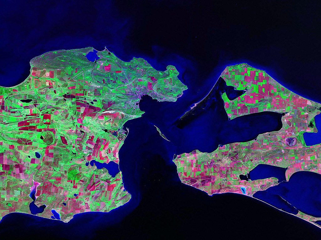
Landsat satellite (false color) photo of Kerch Strait between the Sea of Azov and the Black Sea.
Source: zulu.ssc.nasa.gov
| Camera location | | View this and other nearby images on: OpenStreetMap |
|---|
Licensing
| This file is in the public domain in the United States because it was solely created by NASA. NASA copyright policy states that "NASA material is not protected by copyright unless noted". (See Template:PD-USGov, NASA copyright policy page or JPL Image Use Policy.) | ||
 |
Warnings:
|
File history
Click on a date/time to view the file as it appeared at that time.
| Date/Time | Thumbnail | Dimensions | User | Comment | |
|---|---|---|---|---|---|
| current | 13:52, 17 October 2006 | | 1,600 × 1,200 (294 KB) | commons>Balcer~commonswiki | Landsat satellite (false color) photo of Kerch Strait between the Sea of Azov and the Black Sea. Source:zulu.ssc.nasa.gov Category:Black Sea Category:Satellite pictures of Russia Category:Satellite pictures of Ukraine |
File usage
There are no pages that use this file.