File:Karte Lechtaler Alpen.png
Jump to navigation
Jump to search

Size of this preview: 800 × 583 pixels. Other resolutions: 320 × 233 pixels | 640 × 466 pixels | 1,024 × 746 pixels | 1,280 × 932 pixels | 2,560 × 1,864 pixels | 3,407 × 2,481 pixels.
Original file (3,407 × 2,481 pixels, file size: 2.59 MB, MIME type: image/png)
| Description |
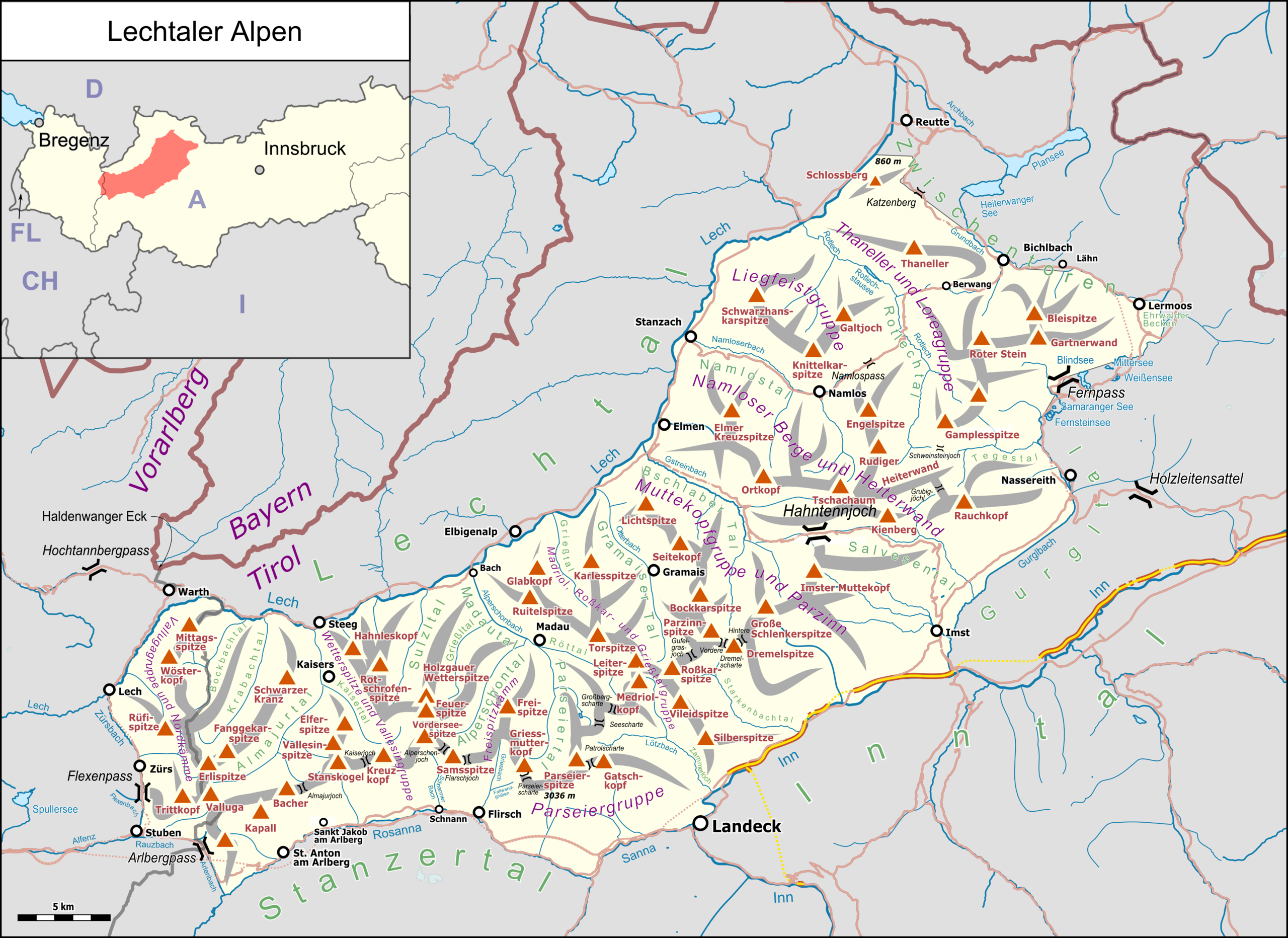
Deutsch: Lagekarte der Lechtaler Alpen. |
|||||||||
| Date | ||||||||||
| Source |
Own work Map was created using:
|
|||||||||
| Creator | ||||||||||
| Permission (Reusing this file) |
Map data (c) OpenStreetMap (and) contributors, CC-BY-SA | |||||||||
| Geotemporal data | ||||||||||
| Bounding box |
|
|||||||||
| Georeferencing | ||||||||||
This file is licensed under the Creative Commons Attribution-Share Alike 2.0 Generic license.
- You are free:
- to share – to copy, distribute and transmit the work
- to remix – to adapt the work
- Under the following conditions:
- attribution – You must give appropriate credit, provide a link to the license, and indicate if changes were made. You may do so in any reasonable manner, but not in any way that suggests the licensor endorses you or your use.
- share alike – If you remix, transform, or build upon the material, you must distribute your contributions under the same or compatible license as the original.
| This work is licensed under the Open Database License (summary). |
File history
Click on a date/time to view the file as it appeared at that time.
| Date/Time | Thumbnail | Dimensions | User | Comment | |
|---|---|---|---|---|---|
| current | 02:23, 8 January 2018 | | 3,407 × 2,481 (2.59 MB) | commons>Pechristener | korr Katzenberg und Berwang |
File usage
There are no pages that use this file.