File:Kaart Hanzesteden en handelsroutes.jpg
Jump to navigation
Jump to search
Size of this preview: 800 × 440 pixels. Other resolutions: 320 × 176 pixels | 640 × 352 pixels | 1,176 × 647 pixels.
Original file (1,176 × 647 pixels, file size: 853 KB, MIME type: image/jpeg)
File history
Click on a date/time to view the file as it appeared at that time.
| Date/Time | Thumbnail | Dimensions | User | Comment | |
|---|---|---|---|---|---|
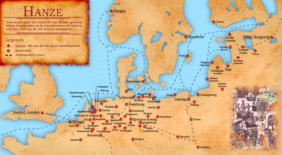
| current | 14:40, 13 December 2008 | | 1,176 × 647 (853 KB) | commons>Doc Brown | {{Information |Description={{en|1=Dutch map of the different small and large Hanseatic Leage cities and trade routes.}} {{nl|1=Nederlandstalige kaart van de verschillende grote en kleine Hanzesteden en de handelsroutes.}} |Source=eigen werk (own work) + B |
File usage
There are no pages that use this file.