File:Jaszsag jazygia map.png
Jump to navigation
Jump to search

Size of this preview: 718 × 600 pixels. Other resolutions: 287 × 240 pixels | 575 × 480 pixels | 894 × 747 pixels.
Original file (894 × 747 pixels, file size: 47 KB, MIME type: image/png)
File history
Click on a date/time to view the file as it appeared at that time.
| Date/Time | Thumbnail | Dimensions | User | Comment | |
|---|---|---|---|---|---|
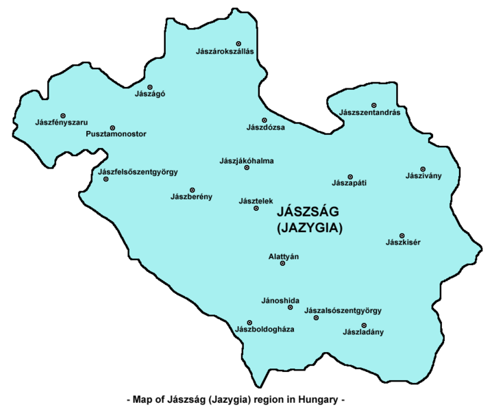
| current | 23:36, 30 September 2009 | | 894 × 747 (47 KB) | commons>PANONIAN | {{Information |Description={{en|1=Map of Jászság (Jazygia) region in Hungary. ==References== Made according to this map: http://www.geographic.hu/ngm/0706/200706/jaszsag/te/map-jasz.jpg }} |Source={{own}} |Author=PANONIAN |Date= |Per |
File usage
There are no pages that use this file.