File:IsleDeMontreal1764.png
Jump to navigation
Jump to search

Size of this preview: 800 × 468 pixels. Other resolutions: 320 × 187 pixels | 640 × 374 pixels | 1,024 × 599 pixels | 1,447 × 846 pixels.
Original file (1,447 × 846 pixels, file size: 1.98 MB, MIME type: image/png)
File history
Click on a date/time to view the file as it appeared at that time.
| Date/Time | Thumbnail | Dimensions | User | Comment | |
|---|---|---|---|---|---|
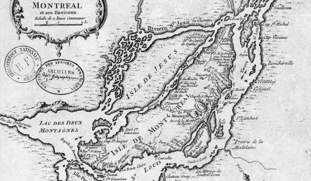
| current | 00:42, 11 January 2009 | | 1,447 × 846 (1.98 MB) | commons>Magicpiano | {{Information |Description={{en|1=This is a detail of the original source map, cropped to depict primarily the Isle of Montreal and immediately surrounding mainland. The map's caption reads "Montreal et ses Environs" (Montreal and its environs).}} |Sourc |
File usage
There are no pages that use this file.