File:Island of Ireland location map Londonderry.svg
Jump to navigation
Jump to search

Size of this PNG preview of this SVG file: 796 × 599 pixels. Other resolutions: 319 × 240 pixels | 638 × 480 pixels | 1,020 × 768 pixels | 1,280 × 964 pixels | 2,560 × 1,928 pixels | 931 × 701 pixels.
Original file (SVG file, nominally 931 × 701 pixels, file size: 826 KB)
| Description |
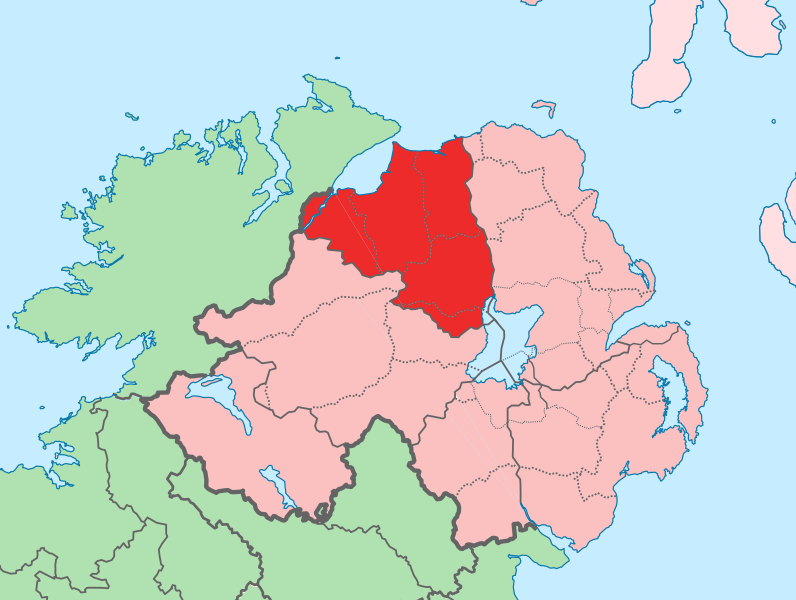
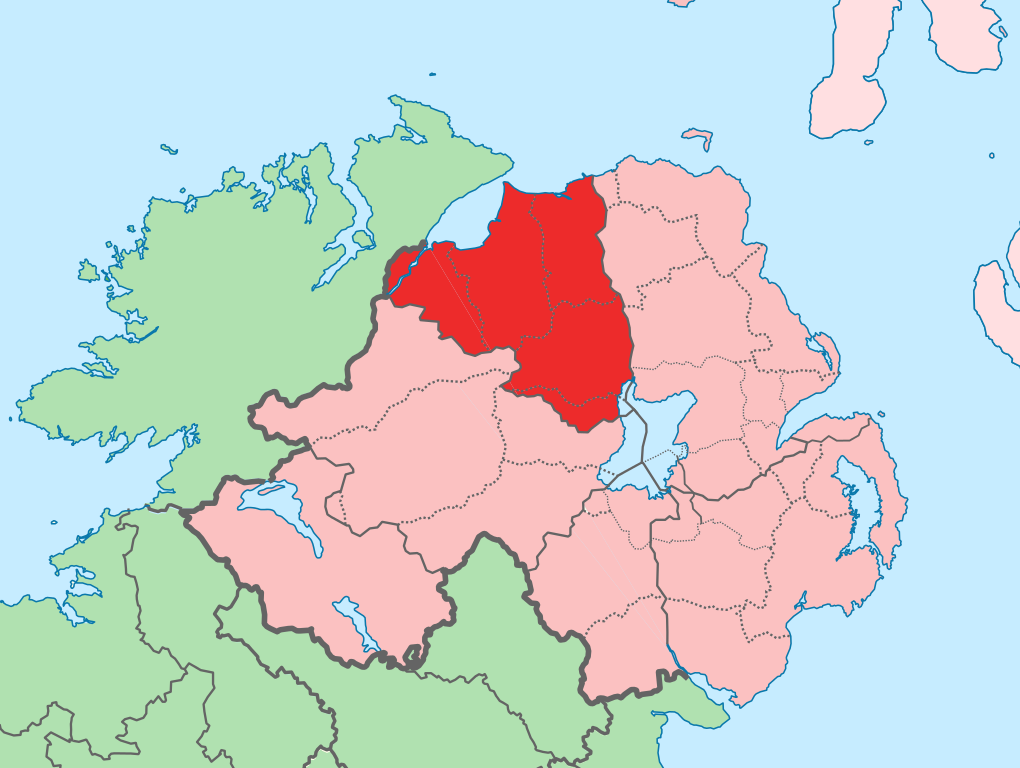
English: The island of Ireland, showing international border between Ireland and Northern Ireland, traditional provinces, traditional counties, and local authority areas in Ireland and Northern Ireland. |
| Date | (UTC) |
| Source | |
| Author |
|
| This is a retouched picture, which means that it has been digitally altered from its original version. Modifications: Added colours to distinguish county in focus. The original can be viewed here: Island of Ireland location map.svg:
|
I, the copyright holder of this work, hereby publish it under the following license:
This file is licensed under the Creative Commons Attribution-Share Alike 3.0 Unported license.
- You are free:
- to share – to copy, distribute and transmit the work
- to remix – to adapt the work
- Under the following conditions:
- attribution – You must give appropriate credit, provide a link to the license, and indicate if changes were made. You may do so in any reasonable manner, but not in any way that suggests the licensor endorses you or your use.
- share alike – If you remix, transform, or build upon the material, you must distribute your contributions under the same or compatible license as the original.
Original upload log
This image is a derivative work of the following images:
- File:Island_of_Ireland_location_map.svg licensed with Cc-by-sa-3.0
- 2010-03-06T20:43:33Z Rannpháirtí anaithnid 1450x1807 (679207 Bytes) Fix incorrectly coloured isands.
- 2010-03-03T22:19:29Z Rannpháirtí anaithnid 1450x1807 (679744 Bytes) {{Information |Description={{de|Positionskarte von [[:de:Irland|Irland]]}} Quadratische Plattkarte, N-S-Streckung 170 %. Geographische Begrenzung der Karte: * N: 55.6° N * S: 51.2° N * W: 11.0° W * O: 5.0° W {{en|Location
Uploaded with derivativeFX
File history
Click on a date/time to view the file as it appeared at that time.
| Date/Time | Thumbnail | Dimensions | User | Comment | |
|---|---|---|---|---|---|
| current | 13:14, 19 July 2010 | | 931 × 701 (826 KB) | commons>Mabuska | another attempt |
File usage
There are no pages that use this file.