File:Iron Curtain map.svg
Jump to navigation
Jump to search

Size of this PNG preview of this SVG file: 560 × 599 pixels. Other resolutions: 224 × 240 pixels | 449 × 480 pixels | 718 × 768 pixels | 957 × 1,024 pixels | 1,914 × 2,048 pixels | 645 × 690 pixels.
Original file (SVG file, nominally 645 × 690 pixels, file size: 322 KB)
File history
Click on a date/time to view the file as it appeared at that time.
| Date/Time | Thumbnail | Dimensions | User | Comment | |
|---|---|---|---|---|---|
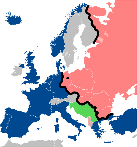
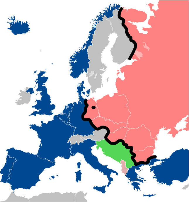
| current | 13:26, 15 December 2022 | | 645 × 690 (322 KB) | commons>PhotographyEdits | Extend the Iron Curtain eastwards of Yugoslavia. Even though Yugoslavia was not really considered part of the West, the currenet map gives the false impression that there was a huge gap in the Iron Curtain, which wasn't the case. |
File usage
There are no pages that use this file.