File:Indian village north of Opelousas on 1820 map of Louisiana.jpg
Jump to navigation
Jump to search

Size of this preview: 323 × 600 pixels. Other resolutions: 129 × 240 pixels | 258 × 480 pixels | 750 × 1,393 pixels.
Original file (750 × 1,393 pixels, file size: 1,006 KB, MIME type: image/jpeg)
File history
Click on a date/time to view the file as it appeared at that time.
| Date/Time | Thumbnail | Dimensions | User | Comment | |
|---|---|---|---|---|---|
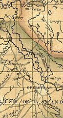
| current | 00:24, 23 July 2023 | | 750 × 1,393 (1,006 KB) | commons>Jengod | Uploaded a work by John Melish from Title Map of Louisiana Names Melish, John, 1771-1822 Created / Published [Philadelphia] : John Melish, [1820] Headings - Louisiana--Maps - United States--Louisiana Genre Maps Notes - Prime meridian: London and Washington. - Available also through the Library of Congress Web site as a raster image. - Stained throughout. Medium 1 map : hand colored, mounted on cloth ; 53 x 70 cm Call Number/Physical Location G4010 1820 .M4 Repository Library of... |
File usage
There are no pages that use this file.