File:India wind zone map en.svg
Jump to navigation
Jump to search

Size of this PNG preview of this SVG file: 530 × 599 pixels. Other resolutions: 212 × 240 pixels | 425 × 480 pixels | 680 × 768 pixels | 906 × 1,024 pixels | 1,812 × 2,048 pixels | 1,639 × 1,852 pixels.
Original file (SVG file, nominally 1,639 × 1,852 pixels, file size: 349 KB)
File history
Click on a date/time to view the file as it appeared at that time.
| Date/Time | Thumbnail | Dimensions | User | Comment | |
|---|---|---|---|---|---|
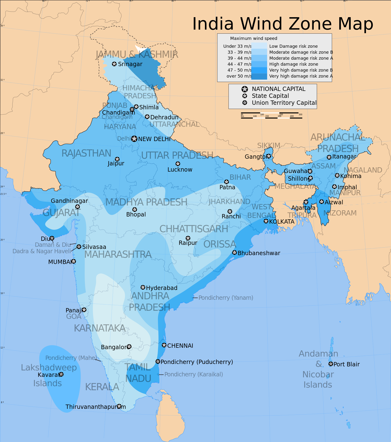
| current | 01:31, 21 March 2007 | | 1,639 × 1,852 (349 KB) | commons>Saravask | {{WikiProject_India_Maps |Title=India wind zone map english version |Description=Map showing the wind and cyclone risk areas in India |Source= [http://www.undp.org.in/dmweb/Multihazard/Maps/wind%20zones/india%20w&c%20map.jpg UNDP wind zone map] |Date=Sept |
File usage
There are no pages that use this file.