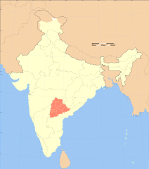
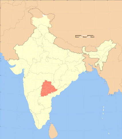
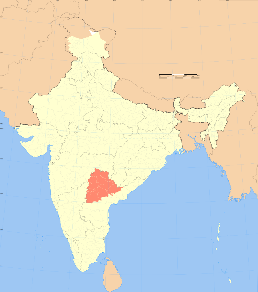
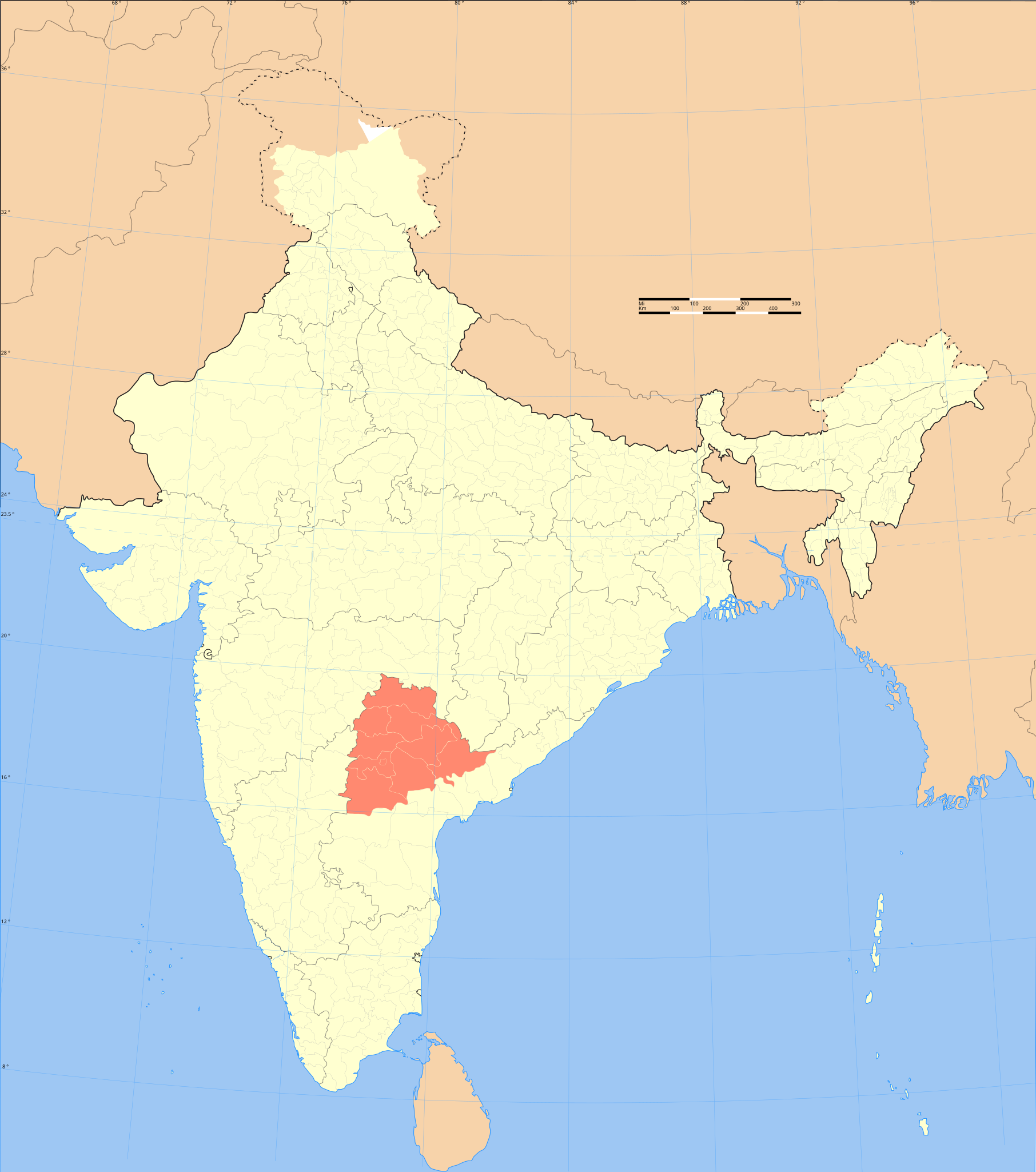
File:India Telangana locator map.svg
Jump to navigation
Jump to search

Size of this PNG preview of this SVG file: 530 × 599 pixels. Other resolutions: 212 × 240 pixels | 425 × 480 pixels | 680 × 768 pixels | 906 × 1,024 pixels | 1,812 × 2,048 pixels | 1,639 × 1,852 pixels.
Original file (SVG file, nominally 1,639 × 1,852 pixels, file size: 795 KB)
File history
Click on a date/time to view the file as it appeared at that time.
| Date/Time | Thumbnail | Dimensions | User | Comment | |
|---|---|---|---|---|---|
| current | 19:14, 20 May 2008 | | 1,639 × 1,852 (795 KB) | commons>Planemad | {{WikiProject_India_Maps |Title=Telangana locator map |Description=Locator map of the region of Telangana, India with district boundaries. |Source=. |Date=September 2006 |Author={{User:PlaneMad/Info}} }} |
File usage
There are no pages that use this file.