File:Hurricane Lane of 2000.JPG
Jump to navigation
Jump to search

Size of this preview: 476 × 599 pixels. Other resolutions: 191 × 240 pixels | 381 × 480 pixels | 610 × 768 pixels | 813 × 1,024 pixels | 1,627 × 2,048 pixels | 5,800 × 7,300 pixels.
Original file (5,800 × 7,300 pixels, file size: 26.51 MB, MIME type: image/jpeg)
Summary
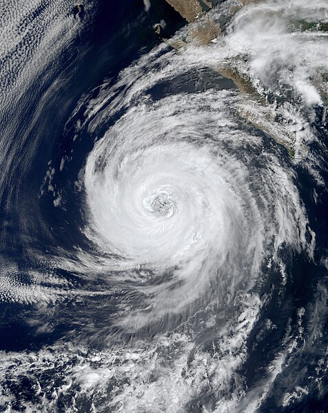
| Description | The spinning cloud pattern of Hurricane Lane is visible in this MODIS image from NASA's Terra satellite. Lane's maximum sustained winds were about 100 mph and its minimum central pressure was about 969 mb during the time of this image capture. | |||||
| Date | ||||||
| Source | http://visibleearth.nasa.gov/view_rec.php?id=1413 | |||||
| Author | Jacques Descloitres, MODIS Land Science Team | |||||
| Permission (Reusing this file) |
|

File history
Click on a date/time to view the file as it appeared at that time.
| Date/Time | Thumbnail | Dimensions | User | Comment | |
|---|---|---|---|---|---|
| current | 09:05, 21 July 2014 | | 5,800 × 7,300 (26.51 MB) | commons>Supportstorm | Higher quality |
File usage
There are no pages that use this file.