File:Homann Amplissimae Regionis Mississipi c. 1720 UTA.jpg
Jump to navigation
Jump to search

Size of this preview: 676 × 599 pixels. Other resolutions: 271 × 240 pixels | 541 × 480 pixels | 866 × 768 pixels | 1,155 × 1,024 pixels | 2,309 × 2,048 pixels | 6,000 × 5,321 pixels.
Original file (6,000 × 5,321 pixels, file size: 16.4 MB, MIME type: image/jpeg)
File history
Click on a date/time to view the file as it appeared at that time.
| Date/Time | Thumbnail | Dimensions | User | Comment | |
|---|---|---|---|---|---|
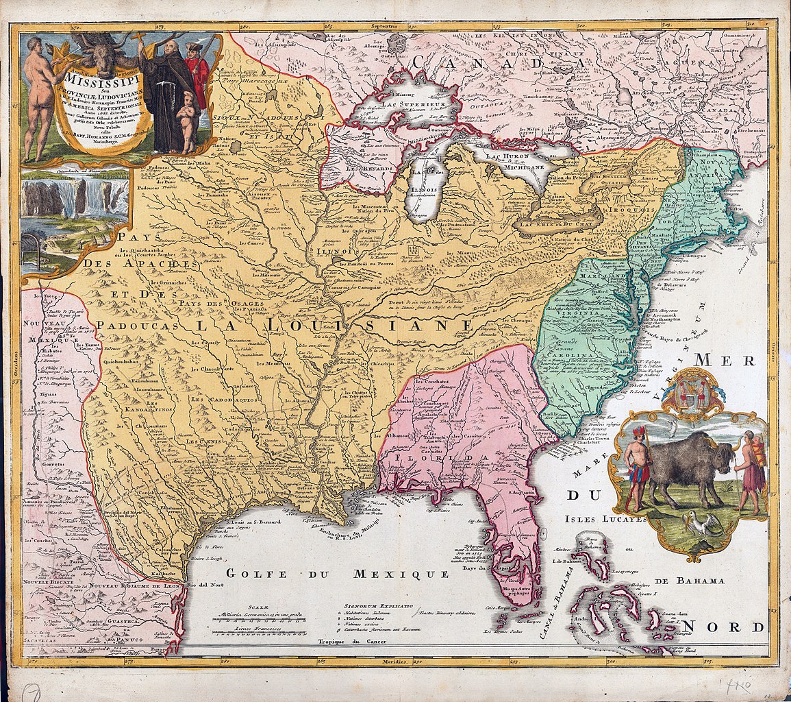
| current | 17:49, 15 February 2022 | | 6,000 × 5,321 (16.4 MB) | commons>Michael Barera | == {{int:filedesc}} == {{Map |title = {{la|'''''Amplißimae Regionis Mississippi seu Provinciae Ludovicianae a R. P. Ludovico Hennepin Francisc Miss in America Septentrionali anno 1687 detecte'''''}} |description = {{en|In the early eighteenth century, Nuremberg cartographer, map publisher, and engraver Johann Baptist Homann paid homage to French Catholic missionary friar, explorer, and cartographer Father Louis Hennepin with this map of Louisiana and the Mississippi Valley... |
File usage
There are no pages that use this file.