File:Gulf Islands map 2.png
Jump to navigation
Jump to search
Size of this preview: 551 × 599 pixels. Other resolutions: 221 × 240 pixels | 441 × 480 pixels | 801 × 871 pixels.
Original file (801 × 871 pixels, file size: 594 KB, MIME type: image/png)
File history
Click on a date/time to view the file as it appeared at that time.
| Date/Time | Thumbnail | Dimensions | User | Comment | |
|---|---|---|---|---|---|
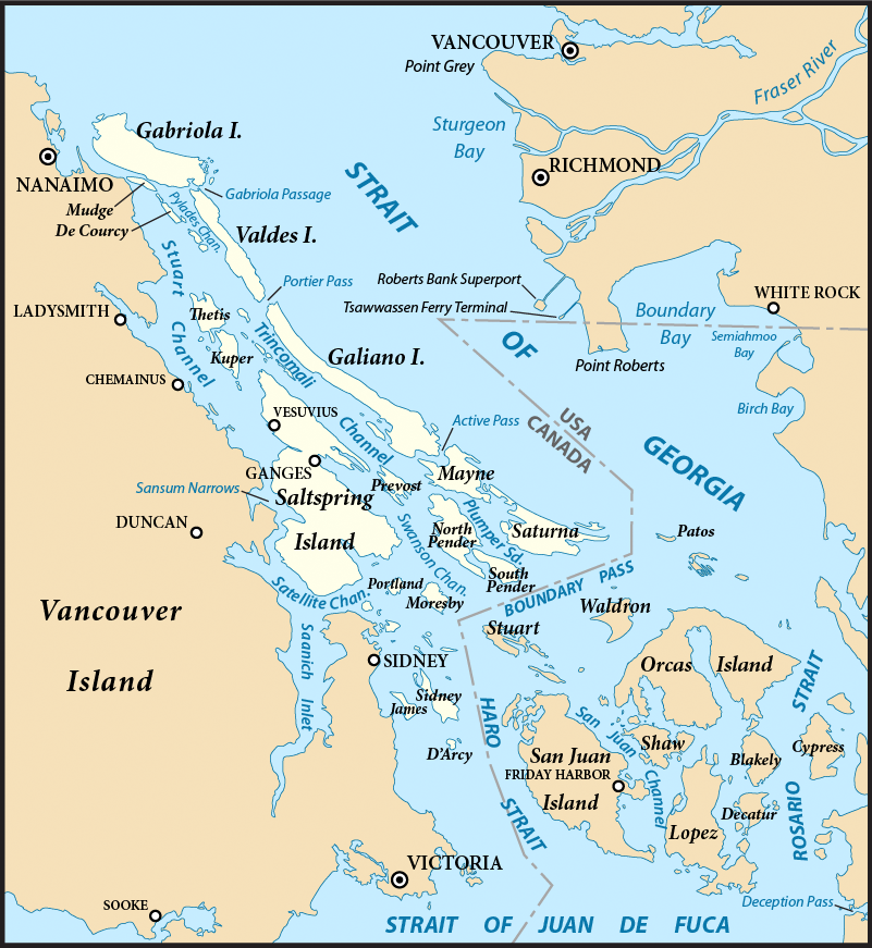
| current | 07:58, 31 July 2011 | | 801 × 871 (594 KB) | commons>Pfly | {{Information |Description ={{en|1=Map of the Gulf Islands (highlighted) and surrounding region. Created with ArcExplorer and Adobe Illustrator. Based on on [[:en:GeoBase (geospatial d |
File usage
There are no pages that use this file.