File:Gokturkut.png
Jump to navigation
Jump to search
No higher resolution available.
Gokturkut.png (754 × 361 pixels, file size: 558 KB, MIME type: image/png)
File history
Click on a date/time to view the file as it appeared at that time.
| Date/Time | Thumbnail | Dimensions | User | Comment | |
|---|---|---|---|---|---|
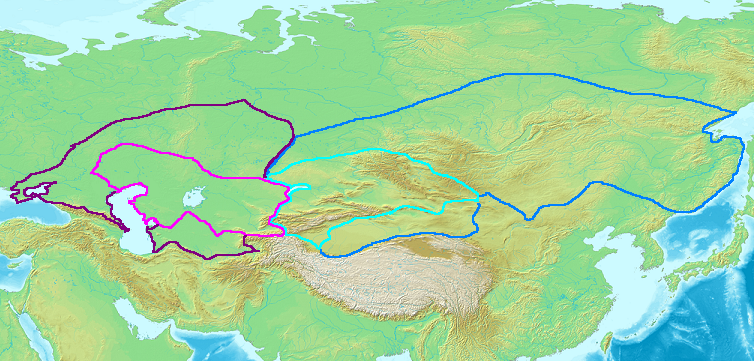
| current | 17:11, 25 October 2006 | | 754 × 361 (558 KB) | commons>Frode Inge Helland | == Summary == Map of the Western (purple) and Eastern (blue) Gokturk khaganates at their height, c. 600 CE. Lighter areas show direct rule; darker areas show sphere of influence. == Licensing == {{GFDL-self}} [[Category:Historical maps by User:Br |
File usage
There are no pages that use this file.