File:Francoprovencal-Geo-Map-1.jpg
Jump to navigation
Jump to search
No higher resolution available.
Francoprovencal-Geo-Map-1.jpg (473 × 473 pixels, file size: 211 KB, MIME type: image/jpeg)
File history
Click on a date/time to view the file as it appeared at that time.
| Date/Time | Thumbnail | Dimensions | User | Comment | |
|---|---|---|---|---|---|
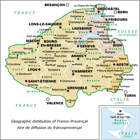
| current | 10:32, 7 December 2007 | | 473 × 473 (211 KB) | commons>Charvex | {{Information |Description=Franco-Provençal language map showing cities & political divisions, Revision 1 |Source=self-made |Date=7 December 2007 |Author= Charvex |Permission=Public Domain |other_versions=Replacement for Francoprovencal- |
File usage
There are no pages that use this file.