File:Foot of the Humber River Toronto1.jpg
Jump to navigation
Jump to search

Size of this preview: 800 × 533 pixels. Other resolutions: 320 × 213 pixels | 640 × 427 pixels | 1,024 × 683 pixels | 1,280 × 853 pixels | 2,592 × 1,728 pixels.
Original file (2,592 × 1,728 pixels, file size: 2.27 MB, MIME type: image/jpeg)
Summary
| Description |
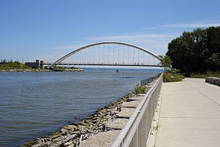
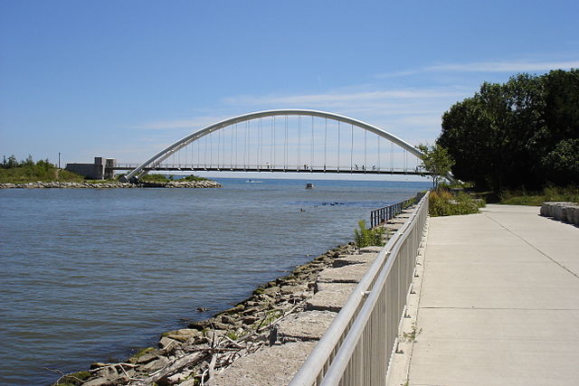
English: Mouth of the Humber River, Toronto, looking south into Lake Ontario. The walkway to the right of the camera's viewpoint follows the river north to the northern limits of Toronto proper, and connects to the Martin Goodman Trail which is running east-west over the pedestrian bridge seen here. |
| Date | 6 August 2005 (according to Exif data) |
| Source | Transferred from en.wikipedia to Commons. |
| Author | Maury Markowitz at English Wikipedia |
Licensing
| This work has been released into the public domain by its author, Maury Markowitz at English Wikipedia. This applies worldwide. In some countries this may not be legally possible; if so: Maury Markowitz grants anyone the right to use this work for any purpose, without any conditions, unless such conditions are required by law. |
Original upload log
The original description page was here. All following user names refer to en.wikipedia.
- 2005-08-24 12:06 Maury Markowitz 2592×1728×8 (2385405 bytes) Foot of the Humber River, Toronto, looking south into Lake Ontario. The walkway to the right of the camera's viewpoint follows the river north to the northern limits of Toronto proper, and connects to the Martin Gardiner Trail which is running east-west o
File history
Click on a date/time to view the file as it appeared at that time.
| Date/Time | Thumbnail | Dimensions | User | Comment | |
|---|---|---|---|---|---|
| current | 12:05, 26 September 2007 | | 2,592 × 1,728 (2.27 MB) | commons>Skeezix1000 | {{Information |Description=Mouth of the Humber River, Toronto, looking south into Lake Ontario. The walkway to the right of the camera's viewpoint follows the river north to the northern limits of Toronto proper, and connects to the Martin Goodman Trail w |
File usage
There are no pages that use this file.