File:Fishers Island Map.jpg
Jump to navigation
Jump to search

Size of this preview: 800 × 514 pixels. Other resolutions: 320 × 206 pixels | 640 × 411 pixels | 1,024 × 658 pixels | 1,280 × 822 pixels | 1,974 × 1,268 pixels.
Original file (1,974 × 1,268 pixels, file size: 480 KB, MIME type: image/jpeg)
Summary
| Description |
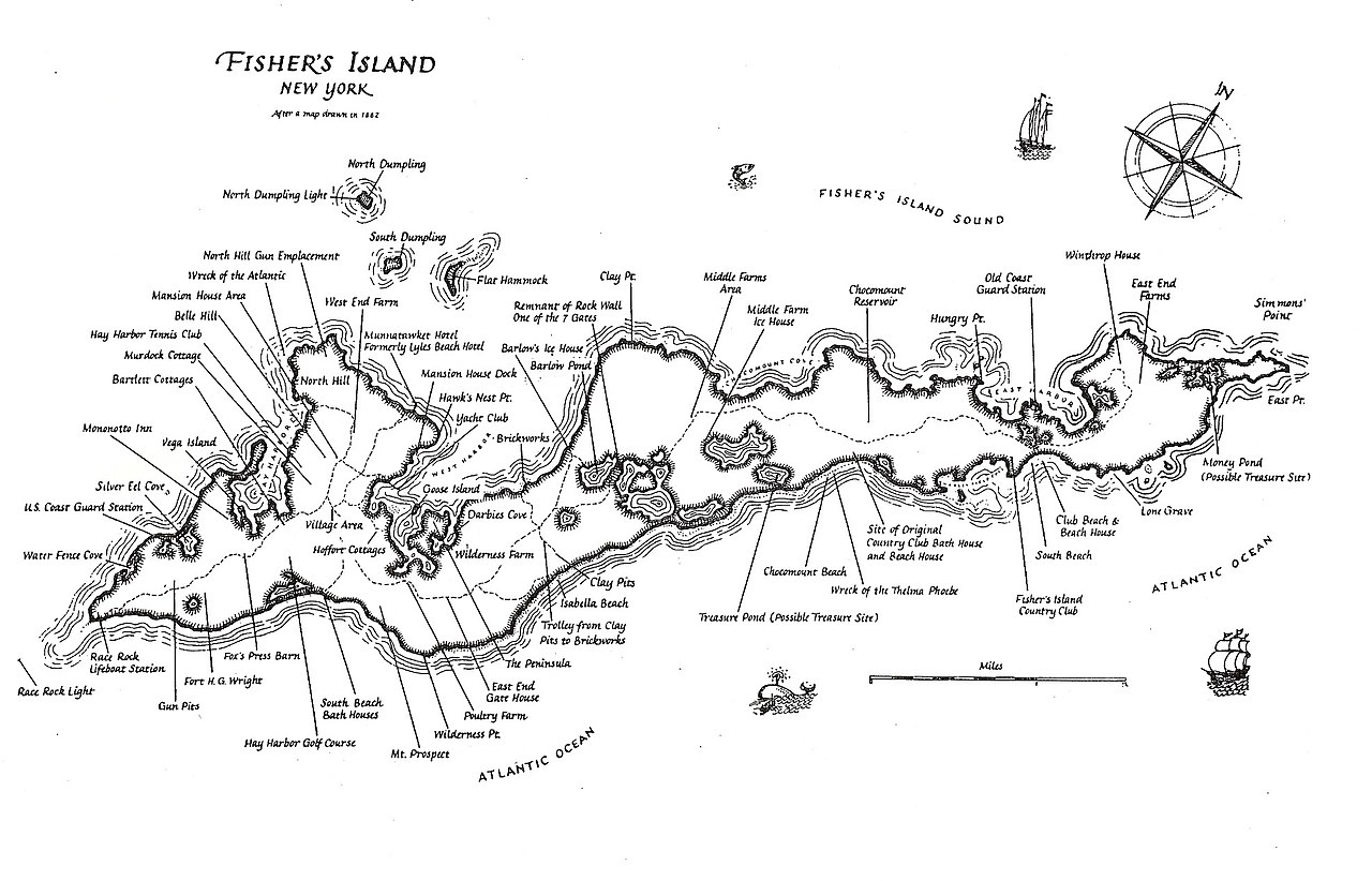
English: Fishers Island Map (by Smarra, after an old map of 1862) |
| Date | 14 February 2008 (original upload date) |
| Source | Own work by the original uploader |
| Author | Smarra |
Licensing
| This work has been released into the public domain by its author, Smarra at English Wikipedia. This applies worldwide. In some countries this may not be legally possible; if so: Smarra grants anyone the right to use this work for any purpose, without any conditions, unless such conditions are required by law. |
Original upload log
The original description page was here. All following user names refer to en.wikipedia.
| Date/Time | Dimensions | User | Comment |
|---|---|---|---|
| 2008-02-14 18:59 | 1974×1268× (491331 bytes) | Smarra~enwiki | {{Information |Description= |Source=self-made |Date= |Location=Fishers Island NY |Author=~~~ |Permission= |other_versions= }} |
File history
Click on a date/time to view the file as it appeared at that time.
| Date/Time | Thumbnail | Dimensions | User | Comment | |
|---|---|---|---|---|---|
| current | 22:33, 25 August 2018 | | 1,974 × 1,268 (480 KB) | commons>Innotata | Transferred from en.wikipedia via #commonshelper |
File usage
There are no pages that use this file.