File:Eu cartogram.png
Jump to navigation
Jump to search
No higher resolution available.
Eu_cartogram.png (490 × 436 pixels, file size: 10 KB, MIME type: image/png)
Summary
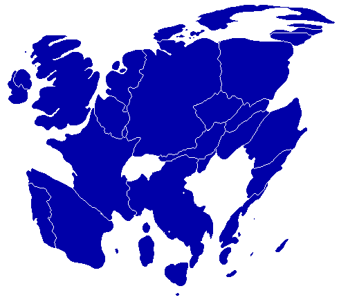
| Description |
English: A cartogram depicting population distribution within the European Union at the member state level. Note how roughly half of all citizens within the EU live within the 4 largest member states: Germany, France, United Kingdom, and Italy. |
| Date | |
| Source | Self-made, referenced from a similiar cartogram at worldmapper.net |
| Author | Geoilex |
Licensing
| I, the copyright holder of this work, release this work into the public domain. This applies worldwide. In some countries this may not be legally possible; if so: I grant anyone the right to use this work for any purpose, without any conditions, unless such conditions are required by law. |
File history
Click on a date/time to view the file as it appeared at that time.
| Date/Time | Thumbnail | Dimensions | User | Comment | |
|---|---|---|---|---|---|
| current | 09:54, 27 March 2008 | | 490 × 436 (10 KB) | commons>Geoilex | {{Information |Description= A cartogram depicting population distribution within the European Union at the member state level. Note how roughly half of all citizens within the EU live within the 4 largest member states: Germany, France, United Kingdom, an |
File usage
There are no pages that use this file.