File:Etolin Strait.PNG
Jump to navigation
Jump to search

Size of this preview: 800 × 478 pixels. Other resolutions: 320 × 191 pixels | 640 × 382 pixels | 845 × 505 pixels.
Original file (845 × 505 pixels, file size: 731 KB, MIME type: image/png)
File history
Click on a date/time to view the file as it appeared at that time.
| Date/Time | Thumbnail | Dimensions | User | Comment | |
|---|---|---|---|---|---|
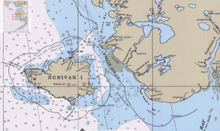
| current | 16:36, 17 September 2009 | | 845 × 505 (731 KB) | commons>Dankarl | {{Information |Description={{en|1=Detail of Bering Sea chart showing Etolin Strait and surroundings}} |Source=Historical Maps and Charts Project http://historicalcharts.noaa.gov/tiled_jpgs_done/zoomifyURLDrivenWebPage.htm?zoomifyImagePath=16006-12-2000 | |
File usage
There are no pages that use this file.