File:Ecclesiastical Province of Philadelphia.svg
Jump to navigation
Jump to search

Size of this PNG preview of this SVG file: 299 × 122 pixels. Other resolutions: 320 × 131 pixels | 640 × 261 pixels | 1,024 × 418 pixels | 1,280 × 522 pixels | 2,560 × 1,045 pixels.
Original file (SVG file, nominally 299 × 122 pixels, file size: 146 KB)
Summary
| Description |
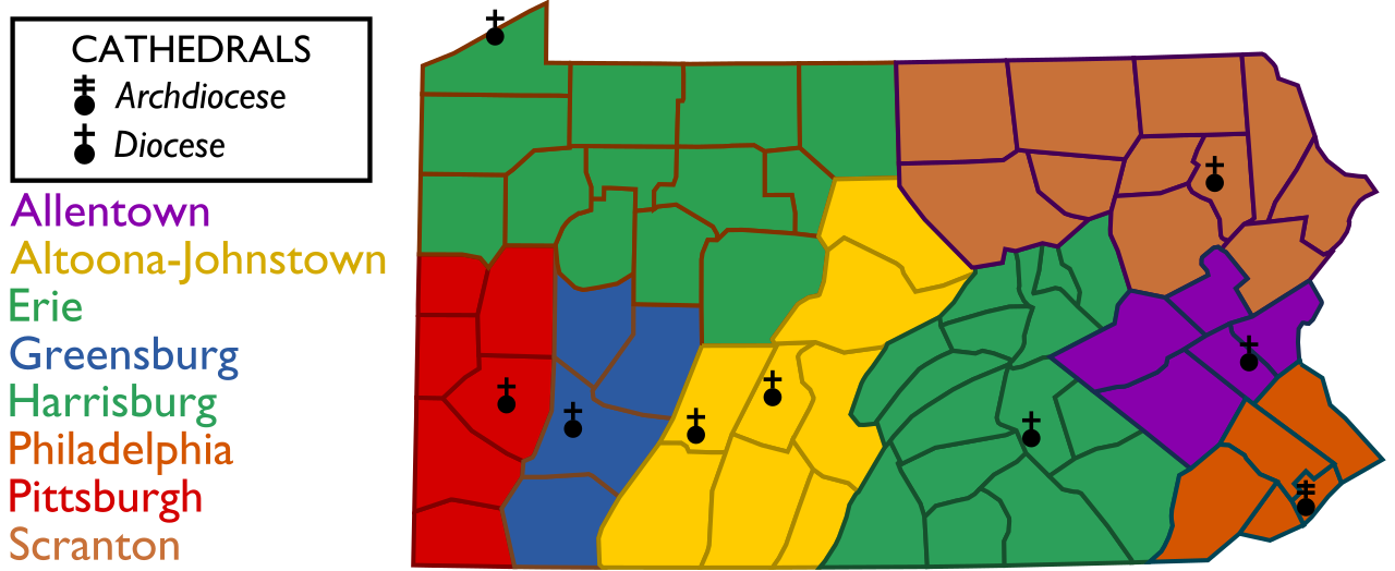
English: This is a map of the constituent dioceses of the Roman Catholic Ecclesiastical Province of Philadelphia, which comprises the Commonwealth of Pennsylvania.
The image Pennsylvania Presidential Election Results by County, 2012.svg was used to create this image. |
| Date | |
| Source | Own work |
| Author | Alekjds |
Licensing
I, the copyright holder of this work, hereby publish it under the following license:
This file is licensed under the Creative Commons Attribution-Share Alike 3.0 Unported license.
- You are free:
- to share – to copy, distribute and transmit the work
- to remix – to adapt the work
- Under the following conditions:
- attribution – You must give appropriate credit, provide a link to the license, and indicate if changes were made. You may do so in any reasonable manner, but not in any way that suggests the licensor endorses you or your use.
- share alike – If you remix, transform, or build upon the material, you must distribute your contributions under the same or compatible license as the original.
File history
Click on a date/time to view the file as it appeared at that time.
| Date/Time | Thumbnail | Dimensions | User | Comment | |
|---|---|---|---|---|---|
| current | 15:30, 27 July 2016 | 299 × 122 (146 KB) | commons>Maproom | Swapped color-labels for Allentown and Scranton, which had been wrong from creation |
File usage
There are no pages that use this file.