File:Dunedin central map.svg
Jump to navigation
Jump to search

Size of this PNG preview of this SVG file: 424 × 600 pixels. Other resolutions: 170 × 240 pixels | 339 × 480 pixels | 543 × 768 pixels | 724 × 1,024 pixels | 1,448 × 2,048 pixels | 744 × 1,052 pixels.
Original file (SVG file, nominally 744 × 1,052 pixels, file size: 85 KB)
File history
Click on a date/time to view the file as it appeared at that time.
| Date/Time | Thumbnail | Dimensions | User | Comment | |
|---|---|---|---|---|---|
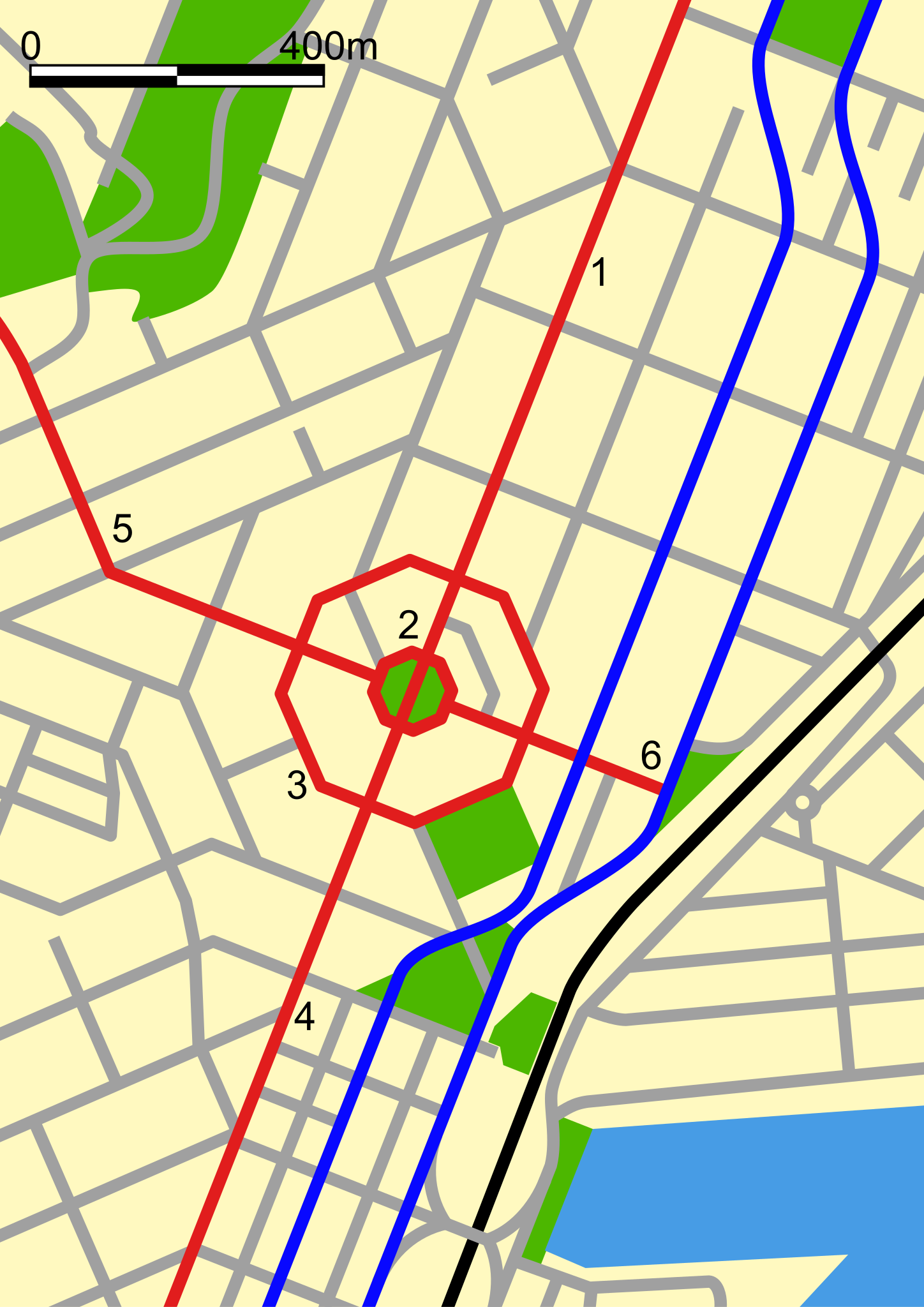
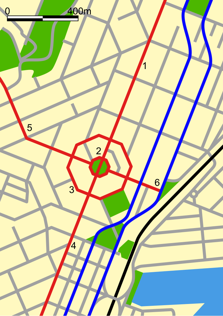
| current | 05:57, 31 October 2007 | | 744 × 1,052 (85 KB) | commons>Benchill | {{Information |Description=Map of central Dunedin, New Zealand. The black line is the railway, the blue lines are the north/south one-way arterial streets, the red lines are: #George Street #The Octagon #Moray Place #Princes Street #Upper Stuart Street #L |
File usage
There are no pages that use this file.