File:Dublin900.svg
Jump to navigation
Jump to search

Size of this PNG preview of this SVG file: 728 × 600 pixels. Other resolutions: 291 × 240 pixels | 583 × 480 pixels | 932 × 768 pixels | 1,243 × 1,024 pixels | 2,485 × 2,048 pixels | 3,526 × 2,906 pixels.
Original file (SVG file, nominally 3,526 × 2,906 pixels, file size: 246 KB)
Summary
| Description |
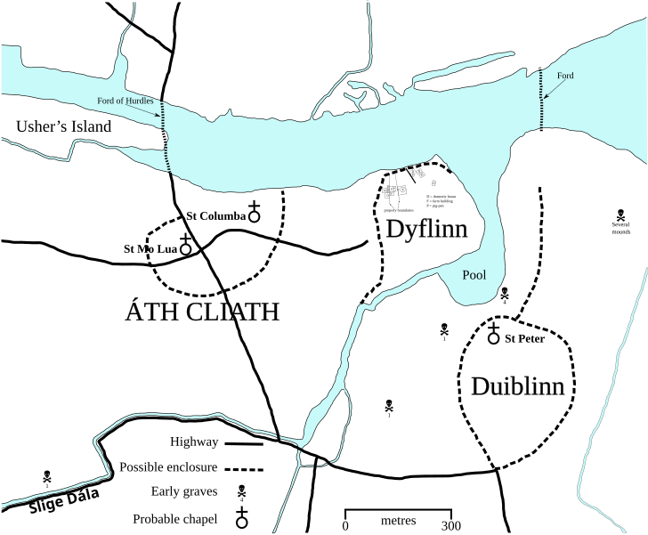
English: SVG map of Dublin circa 900 CE - self-made after H. B. Clarke's maps of Dublin circa 840 and 1000 in Irish Historic Towns Atlas No. 11 (2002) and incorporating data from various archaeological studies. |
| Date | |
| Source | Own work |
| Author | Erigena |
| SVG development |
Licensing
| I, the copyright holder of this work, release this work into the public domain. This applies worldwide. In some countries this may not be legally possible; if so: I grant anyone the right to use this work for any purpose, without any conditions, unless such conditions are required by law. |
File history
Click on a date/time to view the file as it appeared at that time.
| Date/Time | Thumbnail | Dimensions | User | Comment | |
|---|---|---|---|---|---|
| current | 14:56, 24 March 2010 | | 3,526 × 2,906 (246 KB) | commons>Erigena | Reverted to version as of 14:46, 24 March 2010 |
File usage
There are no pages that use this file.