File:Democratic Party presidential primaries results by county, 2016.svg
Jump to navigation
Jump to search

Size of this PNG preview of this SVG file: 800 × 507 pixels. Other resolutions: 320 × 203 pixels | 640 × 406 pixels | 1,024 × 649 pixels | 1,280 × 811 pixels | 2,560 × 1,623 pixels | 989 × 627 pixels.
Original file (SVG file, nominally 989 × 627 pixels, file size: 1.3 MB)
Summary
| Description |
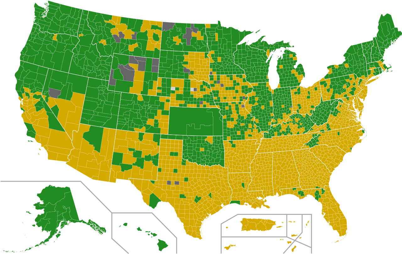
English: Map of the Democratic Party (United States) presidential primaries, 2016 by county.
Hillary Clinton Bernie Sanders Tie No results |
||||||||||||||
| Date | |||||||||||||||
| Source |
This file was derived from: USA Counties.svg |
||||||||||||||
| Author | Ali Zifan, Prcc27, AHC300, Jc86035, Abjiklam, Magog the Ogre, Sleepingstar, Jvikings1, JCRules, Kingofthedead, Tld1060 and Gage | ||||||||||||||
| Permission (Reusing this file) |
I, the copyright holder of this work, hereby publish it under the following license:
|
||||||||||||||
| Other versions |
[]
|
||||||||||||||
| SVG development |
.svg)
.svg)


.svg)
.svg)
_by_election_methods,_2016_(Republican_Party).svg)
.svg)


.svg)
.svg)
.svg)


.svg)
.svg)
_by_election_methods,_2016_(Democratic_Party).svg)


| Annotations | This image is annotated: View the annotations at Commons |
File history
Click on a date/time to view the file as it appeared at that time.
| Date/Time | Thumbnail | Dimensions | User | Comment | |
|---|---|---|---|---|---|
| current | 21:51, 11 December 2016 | | 989 × 627 (1.3 MB) | commons>WikiBunny2K1 | Corrected some Nebraska counties |
File usage
There are no pages that use this file.