File:Danubemap.jpg
Jump to navigation
Jump to search
Size of this preview: 800 × 577 pixels. Other resolutions: 320 × 231 pixels | 640 × 462 pixels | 998 × 720 pixels.
Original file (998 × 720 pixels, file size: 389 KB, MIME type: image/jpeg)
File history
Click on a date/time to view the file as it appeared at that time.
| Date/Time | Thumbnail | Dimensions | User | Comment | |
|---|---|---|---|---|---|
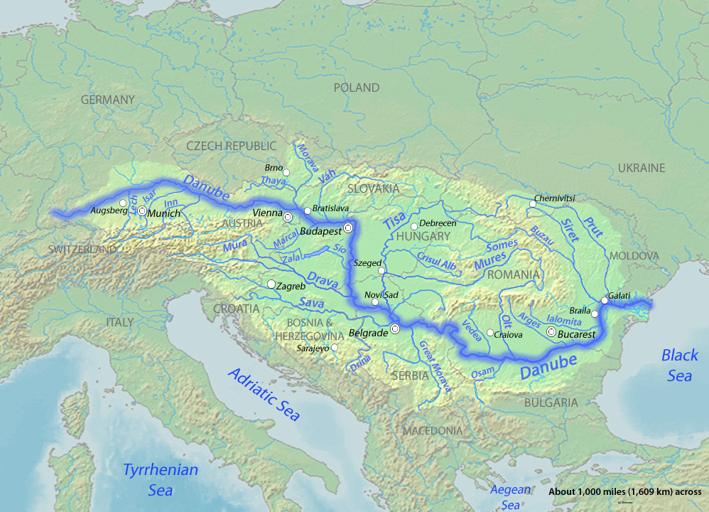
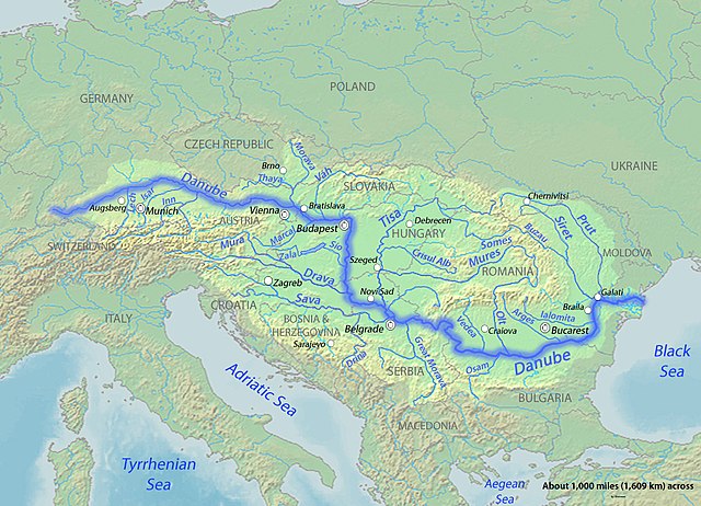
| current | 05:13, 24 March 2010 | | 998 × 720 (389 KB) | commons>Shannon1 | {{Information |Description={{en|1=Map of the Danube, the largest river of Central Europe. Created to fill a gap in which all the other Danube maps do not fulfill.}} |Source=Background and river course data from http://www2.demis.nl/mapserver/mapper.as |
File usage
There are no pages that use this file.